
По всем вопросам обращайтесь на: info@litportal.ru
(©) 2003-2024.
✖


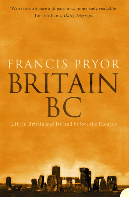
Britain BC: Life in Britain and Ireland Before the Romans
Настройки чтения
Размер шрифта
Высота строк
Поля
John’s style of excavation was rather like that of Stephen Aldhouse-Green, somewhat more recently. Both are neat and extremely meticulous, and both make a point of recording everything they find three-dimensionally. This takes time and effort; it also only happens if the crew actually doing the work are happy and highly motivated – and that’s the real skill of a successful dig director: somehow he must keep people informed and enthusiastic, otherwise they won’t willingly do what he asks them.
The most important concentration of occupation debris at Thatcham was unearthed in an area known as Site III, where John had not expected to find much. Like the other settlement sites it was located on the edge of a slope which dipped down to reed beds along an edge of the river floodplain. In Mesolithic times it would have been on the edge of a large lake. The area in question was actually a shallow dip when seen from the surface, and John had quite reasonably expected to find better evidence for settlement on the drier humps than in the damper hollows. But in this case his guess was wrong, which, paradoxically, is why he is such a good field archaeologist. A lesser man would only have put trenches where he expected to make discoveries. A good archaeologist, however, is always aware that he must break the mould, destroy the predictable chains of reasoning.
Like other sites at Thatcham, Site III was dug by yard (metre) squares, and flints were recorded to the appropriate square. As the crew worked they were amazed by the density of flints they found: sometimes as many as two to three hundred per square, and in one extraordinary instance a massive 764. In amongst the flints were numerous burnt pebbles, burnt and unburnt bones, burnt hazelnuts and spreads of charcoal, clear evidence for hearths or fires – and indeed for food, both meat and nuts. This was clearly a domestic site, and clearly too it had been occupied more than once, because some of the flints showed signs of having been worked twice. The sheer quantity of material also indicated repeated use of the place.
There were also some areas of Site III where there were low densities of flints. If we plot the densities at Site III, we notice that there’s an area near the centre of the site which is relatively free from flints and surrounded also by hearths. If one assumes that flint-working was an activity best carried out in the open (as we saw, for example, at Boxgrove), this could well have been a place where light structures were erected when people returned to the site. It measures about 6.5 by 5.5 metres, and has a floor area of some thirty-five square metres – large enough for a single family. In northern Europe there is evidence that early postglacial people made houses by bending birch saplings and covering them with hides. These are about the same size as the possible house-sized space at Thatcham.
It seems probable that more than one family occupied the ridge at Thatcham, and that, like other communities of the time, they were mobile. Their home-base was probably occupied in the summer months, and analysis of pollen shows it to have been positioned within birch woodland, on the edge of the lake.
(#litres_trial_promo) They hunted a variety of animals, including both native species of deer, and wild pig (a term I prefer to ‘wild boar’, which implies that all the animals are male) was particularly important.
Once in a while it happens that an archaeologist excavates a site and publishes a report in which he speculates about its date and function, then someone else comes along ten years later, with the improved techniques of the time, and proves him right or wrong. It happened to me a few years ago, and I was proved wrong – but in the nicest possible way.
(#litres_trial_promo) It happened to John Wymer too – and of course he was proved right. Another spread of flint on the same ridge, but about two hundred metres to the north-west, was excavated in 1989.
(#litres_trial_promo) This revealed a pattern of sharp rises and falls in the density of flints found on the ancient surfaces, just as John had done, but the excavators now had available the newer technique of microwear, or use-wear, analysis. Essentially this is a way of examining microscopic damage to the scraping and cutting edges of flint tools, but it requires flints from sealed contexts, such as Thatcham (where the occupation levels were covered by a layer of peat), otherwise it’s hard to discount the ‘noise’ caused by more recent, post-depositional effects, such as plough damage.
The technique relies on the controlled experimental ‘use’ of flints, which are then examined, and the results compared with the ancient material. The microscopic edge-damage found at kill or butchery sites is very characteristic and includes, as one might expect, evidence for percussion and harsh damage, when joints are severed and bones are broken. There will also be arrowheads and projectile points at such sites. A domestic site – a home-base, in other words – produces a far more diverse pattern of edge-wear. The heavy-duty percussive damage tends to be lacking, as are quantities of arrowheads, and there are more signs of scraping hides and sinews, and of cutting soft materials, such as vegetable matter. The range of flint implements found at Thatcham, and the edge-wear revealed in the microwear analyses, showed that it had indeed been a domestic site. John had been right: it was a true home-base.
It cannot have escaped attention that up till now I have been writing about Britain alone – as if Ireland was floating out over the horizon, miles away in the Atlantic. Of course it wasn’t, but neither was it inhabited by human beings in the Ice Age, with the possible exception of the odd visitor or two at the close of the Lower Palaeolithic.
(#litres_trial_promo) For practical purposes Ireland’s earliest Stone Age was the Mesolithic. It is a very well-preserved Mesolithic, with some fascinating stories to tell.
I have a soft spot for Ireland and the Irish. My mother came from an old Anglo-Irish family who went to Ireland in the sixteenth century, essentially as English mercenaries to fight in the Desmond Wars of County Wexford. They built a moated tower house, Huntington Castle, on the borders of Counties Wexford and Carlow in 1625, and are living there to this day. My grandmother, Nora Robertson, wrote a wonderful account of the Anglo-Irish Ascendancy which I keep by my bed and dip into regularly.
(#litres_trial_promo) I have never had the privilege of excavating in Ireland, but I would love to do a dig there one day.
It is well known that Ireland has a long tradition of close relations with the United States, and this extends to archaeology, too. I remember when I worked at the Royal Ontario Museum in the early 1970s being recommended to read the reports of the Harvard University Irish Project of the 1930s. Not only were these a model of how to do good field archaeology, but they were published promptly and in sources that were readily accessible to the ‘natives’, and in a language that they could understand. This was in contrast to what was going on elsewhere in the world, especially in the Near East, Western Asia and South America. I can imagine how indignant I’d feel if the standard reference work on the archaeology of East Anglia was published in Russian.
Ireland was cut off from the rest of Britain by rising sea levels at some time around 7500 BC. Thereafter anyone wishing to settle in what we still assume was an uninhabited island had to come by way of a short sea crossing. Actual physical evidence for Earlier Mesolithic boats has yet to be found in Britain, but dug-out, canoe-style logboats have been found in Denmark,
(#litres_trial_promo) and possible logboats of the Mesolithic to Neolithic transition period are known in Britain.
(#litres_trial_promo) These are generally too rigid and inflexible for long sea-crossings, unless fitted with outriggers or double hulls, and would more likely have plied inland waterways such as Lake Flixton (a possible paddle was found at Star Carr). We also know from rock carvings in Scandinavia and elsewhere that skin-covered craft existed in prehistory. These would have been similar to the curraghs that I remember seeing bobbing about in the Atlantic surf off County Galway as a boy. Such vessels could perfectly well have crossed the narrow channel separating Britain from Ireland in the mid-eighth millennium BC.
For a long time the version of the Irish Mesolithic established by the Harvard expeditions of the 1930s held sway, but then a young archaeologist working close to the river Bann, in County Antrim, changed all that. Peter Woodman’s discoveries at Mount Sandel, a settlement on a thirty-metre-high bluff or sandy bank alongside the river, showed that the gap that separated the world of the hunter/gatherers and the very first (Neolithic) farmers was by no means as wide as we used to believe. He has also helped to fill in that central void at Thatcham – the one surrounded by hearths and huge numbers of flints. I remember well when the first pictures of his dig appeared in the archaeological literature. I couldn’t believe my eyes: his meticulous excavations had revealed the clearest evidence possible for lightweight, tent-like houses built by these hunters of the Later Mesolithic.
The site has been dated by radiocarbon to about 6500 BC, so it’s significantly later than Thatcham or Star Carr, but in many respects it’s quite similar.
(#litres_trial_promo) It’s positioned near water in woods of birch and hazel, but unlike either English site, Peter Woodman’s excavations produced huge quantities of fishbones, of which salmon and sea trout were by far the commonest. This gives us an important clue as to the time of year the site would have been occupied. Both fish are migratory, and enter rivers from the sea to spawn in summer and autumn. It seems most probable that this was when the site was occupied. We don’t know where the occupants went for the rest of the year, although the seaside is a possibility. Other evidence shows that their food was not confined to these very delicious fish; they also ate eel, wild pig, various birds including game birds, and hazelnuts. I can think of worse diets.
Mount Sandel is principally famous for its lightweight houses, which are still, I believe, the oldest proven domestic structures in the British Isles. There were two types. Six examples of the first type were found. It consists of a roughly circular or oval arrangement of angled stake- or post-holes, plus a doorway; sometimes there’s also evidence for a central hearth. The house was probably built from curved or hooped poles covered with hides, and the average size was just over five metres across, giving a floor area of about thirty square metres, which is broadly comparable with the ‘void’ area at Thatcham.
The second type of house was more tent-like, and about half the size of the hooped pole structures. It consists of four banana-shaped, shallow ditches or gullies arranged in a rough circle. Presumably these were dug to take the run-off of water from a tent-like structure. There’s no evidence for post-holes, so we must assume the framework didn’t need to be securely anchored, being structurally stable and able to shed all but the severest of gales. In this instance the hearth was positioned outside, but opposite, the entranceway.
Both styles of structure are lightweight and appropriate to people whose pattern of life requires movement through the landscape. Can we call them houses? I don’t see why not. A house is where people choose to live. As soon as we start to talk about ‘huts’ – or worse, ‘shacks’ – we do these buildings a disservice. The small structure within the four gullies at Mount Sandel is undoubtedly a tent-house, the other is a house, albeit a lightweight one. I strongly dislike the term ‘hut’, which I see in the archaeological literature far too often. Huts are for wheelbarrows and garden tools, not for people.
We’ve looked at Mesolithic settlements in England and Ireland, but what was happening further north, in Scotland – was it too cold for settlement in postglacial times? The answer is that it wasn’t; Scotland has produced plentiful evidence of life in the period. One of the most revealing sites was excavated by John Coles, who lectured to me on the Palaeolithic at Cambridge and co-authored the standard textbook of the day.
(#litres_trial_promo) He also lectured on the European Bronze Age, and a few years later co-authored another standard work.
(#litres_trial_promo) At the time he was busily engaged in experimental archaeology, and was dipping his toes into the waters of wetland archaeology, which posterity will probably judge to have been his major contribution. So he’s a man of many parts, which is perhaps why he was invited to take over an existing Mesolithic excavation at Morton, in the Kingdom of Fife, in 1967. The main dig took place in 1969 and 1970.
(#litres_trial_promo)
I should perhaps note here that we still know of no evidence for postglacial occupation in Scotland before about 9000 BC. To the best of my knowledge the earliest site on the mainland is currently Cramond, near Edinburgh, which has produced radiocarbon dates from hazelnut shells to around 8500 BC.
(#litres_trial_promo) This is remarkably early, given the fact that it is generally agreed that most of Scotland would still have been uninhabitable before around 9600 BC.
Like most other Mesolithic sites, Morton shows clear evidence for more than one episode of occupation, and there are at least two centres of interest, which are known as Sites A and B. Today these are located a short distance inland, but in the fifth millennium BC they would have been very close to the shoreline. Radiocarbon dates indicate the sites were occupied three or four centuries before 4000 BC. So we are now approaching the end of the Mesolithic in this particular part of Scotland. Elsewhere in Britain some formerly Mesolithic communities will already have started to adopt the techniques of farming – to become in effect Neolithic.
Morton isn’t far from St Andrews, the home of golf, and the countryside round about reflects this, being gentle and undulating. In the fifth millennium BC the area was cloaked in open oak woodland (with elm) and an under-storey of hazel. These woods probably didn’t extend right down to the shoreline, which is where we find our two areas of occupation.
I hesitate to call both Sites A and B settlements, because Site B was very specialised, being in effect a huge dump or midden – a mound no less – of seashells. Mesolithic shell midden mounds are found in many places around the coasts of Britain and Ireland, but the shores of Scotland and the Western Isles boast some of the largest. Some are massive: substantial hillocks you could build a small bungalow on. They demonstrate, among other things, that shellfish were a highly important part of the seasonal round. The shells of shellfish such as the common cockle grow at varying rates at different times of year, in response to a variety of factors including air/water temperature and the salinity of the seawater. Using the information encoded within the shells at Morton, Margaret Deith of Cambridge University was able to demonstrate that a high proportion of them had been harvested high on the beach, and that no particular season seems to have been favoured.
(#litres_trial_promo) If anything, wintertime, when the meat of cockles is less nutritious than in summer, was the most popular period for visiting Morton beach.
The impression gained is of opportunistic visits, the way one ‘grabs a bite’ whilst busily engaged in something else – at Morton this may have been the collection of suitable beach pebbles from which to fashion implements. The midden did however show clear signs that small temporary squats or camps had been scooped into it, perhaps as refuges from the worst of the wind. The surviving mound of shells was large, gently curving, and about thirty by 3.5 metres; its maximum thickness was 0.78 metres. At one point John Coles was able to identify a succession of five scoops or hollows which were floored with an occupation deposit – essentially crushed shells and an organic ‘dark earth’ – and showed clear signs of human use, including ‘bashed lumps’, stones that had been roughly hit to provide usable cutting edges and sharp points. But the signs of settlement on the midden were far less intensive than at Site A, about 150 metres to the south. The midden produced just 372 stone artefacts – compared with over thirteen thousand on Site A – and large quantities of fish and mammal bones, including red and roe deer, wild cattle and pig. By way of numerical compensation, it was composed of some ten million shells.
Why did these vast mounds of shells accumulate? The beach is a very hostile environment, lashed by winds, waves and storms. Heaps of shells wouldn’t last for long unless (a) they were carefully positioned to be out of the reach of storms and tides, and (b) people wanted them to build up, and took pains to see that they grew every season. I think it’s absurd to suggest that these great mounds were simply piles of rubbish, and had no other role. In any case, if a site was seen merely as being suitable for disposing of food refuse, it would surely not be regarded as appropriate for settlement, as happened at Morton, however short-lived. It seems to me that these great middens also served a symbolic role – perhaps marking out the position of a particular band’s stretch of beach – in some respects rather like the similarly-shaped long barrows of the Neolithic, which I’ll discuss in Chapter 8. If this idea has any validity at all, it knocks on the head the idea that Mesolithic people didn’t construct, or understand, monuments and the symbolism lying behind them. Traditionally the introduction of monuments has been regarded as a strictly Neolithic innovation, but a few hints are beginning to emerge that it was never quite as straightforward as that. As we will see, some very strange things indeed were happening in the area that was to become the Stonehenge car park. But more on this later.
Site A at Morton didn’t produce evidence for lightweight houses, or spaces for them, as convincing as Mount Sandel or Thatcham. Post-holes, even decayed fragments of wood, did survive, but were never arranged in patterns that suggested any sort of permanence. They more resembled windbreaks, or temporary shelters over sleeping places, than dwellings as such.
Bones from Morton revealed that cod, and even sturgeon, were eaten, but the size of these bones suggests that they were caught offshore (what my local fishmonger flags up as ‘long shore cod’), most probably from skin boats. Birds were also taken, including guillemot, gannet and cormorant, which nest on cliffs nearby and can be caught in the spring by an intrepid, or hungry, climber.
Morton wasn’t a permanent settlement or a home-base. It was a place visited at several times of the year by a mobile band of hunters whose home-base was probably not far distant. Although visited episodically, it gives us an impression of stability: it would have been familiar to the people who used it, part of the seasonal round. Maybe on certain visits, perhaps to collect suitable stone for making tools, only a few people came, possibly for a day and a night, stopping over in temporary shelters on the midden. They would have recognised the little headland and its accompanying inlet as ‘theirs’, and would have been well aware of why they were there. The landscape was becoming sufficiently populated for people to carry clear maps within their heads. The slow process of dividing up Britain was beginning to gather momentum. Soon it would become an irresistible force.
This brings me to the question of population in the Mesolithic period. It will, of course, always be difficult to estimate prehistoric populations, simply because the basic data – the sites and finds – which one has to use are constantly changing. This does not mean that one shouldn’t make the effort. One particularly well-thought-out attempt to chart population trends in postglacial Britain (excluding Ireland) was made by Christopher Smith in 1992.
(#litres_trial_promo) He based his calculations not on individual sites, but on the evidence provided by ten-by-ten-kilometre squares, reasoning that in highly mobile societies simply counting sites was probably going to involve a great deal of replication and distortion, because the same band of people would have occupied more than one in a single season, while an area as large as a hundred square kilometres would probably contain all the seasonal stopping-off points of a single group. It may be easy to suggest pitfalls in this hypothesis, but then, it’s very much harder to come up with anything better. So I’m happy to stay with it.
Smith’s paper was principally concerned with the rate at which population growth happened. He notes a steadily rising British population in the centuries before the Loch Lomond cold episode, then retreat, followed by growth leading to rapid growth thereafter. By 5000 BC he believes growth slowed down or ceased – only to pick up again, as we will shortly see, in the subsequent Neolithic period. He steers clear of actual numbers, but does commit himself to some broad estimates: 1100 to 1200 people at 9000 BC; 1200 to 2400 by 8000 BC. Then there was a period of rapid growth, leading to an estimate of 2500 to five thousand people by 7000 BC. By the end of the period (approximately 5000 BC) the range was 2750 to 5500.
(#litres_trial_promo)
Smith used material he assembled for his Late Stone Age Hunters of the British Isles for his paper on population, which was published in the same year (1992). As we noted earlier, in this book he stayed clear of the more usual flinty typological approach to the subject, and instead viewed the people of the Mesolithic for what they were, namely hunters. As time passed they seem to have become somewhat less mobile, and the territories each band controlled became progressively smaller – as, for example, at Morton. Perhaps this more sedentary way of life was accompanied by a slightly greater reliance on gathered and stored vegetable foods, such as hazelnuts. It’s remarkable how productive a large stand of hazelnut bushes can be.
(#litres_trial_promo) I imagine it would not be difficult, in an unrestricted area of mature woodland, for a group of people working full-time in the autumn to fill the equivalent of several wheelbarrows with hazelnuts, which could then be stored above or below ground, in pits.
I concluded the previous chapter with Clive Gamble’s thoughts on the nature and structure of Palaeolithic society. How did British society change in the Mesolithic? The consensus of opinion would suggest that structurally it altered very little.
(#litres_trial_promo) Certainly the population grew, and grew quite quickly, but there was plenty of country to absorb this expansion. In other words, people didn’t live in such close proximity that disputes and rivalry for scarce resources could give rise to social competition, which might in turn lead to the development of more formally organised, hierarchical communities.
It has been suggested that one of the signs that societies have moved beyond the simple group or band level of organisation is the appearance of cemeteries, which start to appear in the Late Mesolithic right across northern Europe, including the Baltic and Scandinavia. Cemeteries might also be taken to indicate sedentism, as they would make little sense in a highly mobile world. But for some reason they don’t appear in Britain at this time.
There are three possible reasons for this. The most obvious is that communication across the ever-wetter North Sea basin was becoming more difficult, and after 7000 BC it effectively became impossible without a sea-going boat. It could also be argued that the British Mesolithic patterns of life were admirably suited to islands with a long and intricate coastline. Societies had to remain mobile in order to exploit the seasonally available marine and land-based sources of food properly. So why change? Indeed, in coastal areas of Scotland and Ireland this pattern of living was so successful that an essentially Mesolithic way of life continued pretty well unaltered until as late as 3000 BC.
(#litres_trial_promo) A third explanation, which I suspect might turn out to be the true one, is that we haven’t yet struck lucky. On the mainland of Europe, Mesolithic cemeteries tend to occur outside the areas of settlement, as indicated by scatters of flints on the ground surface. To date in Britain we’ve tended only to excavate the ground beneath flint scatters, because we know there will be something to reveal there. I think it will take an accident, or a chance find of some sort, to reveal the first hunter/gatherer cemetery.
Другие электронные книги автора Francis Pryor
Последний отзыв
книга нужная