Последний отзыв

Удивительная книга. Как никогда актуальна сегодня. Язык и стиль автора настолько тонок, лёгок и изыскан, что легко поведёт читателя в мир героев, кото...
Далее
По всем вопросам обращайтесь на: info@litportal.ru
(©) 2003-2024.
✖


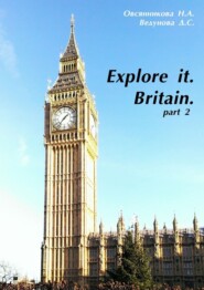
Explore it. Britain
Настройки чтения
Размер шрифта
Высота строк
Поля
1. Who is the head of state in Scotland?
2. How long has Scotland got its Parliament?
Wales
Wales is located in the west of the island of Great Britain. In the west and north it is bordered by the Irish Sea (Irish Sea – Môr Iwerddon, St. George’s Channel), in the south it is bordered by the mouth of the River Severn (Bristol Channel). To the east its boundary is defined by the administrative division of the United Kingdom. Most of the territory is occupied by the various Welsh mountains. The main are the mountains of Wales (Cambrian Mountains) with the highest points of Snowdon (Snowdon – Yr Wyddfa). This mountain is 1085 m above sea level, Cader Idris (Cadair Idris) is 892 m and Plinlimon (Plynlimon) is 752 m. South West Wales is comparatively low, hilly region, and to the south there are the mountains of the Brecon Beacons (Brecon Beacons – Bannau Brycheiniog). This area is relatively young compared to Cambrian Mountains and contain significant reserves of coal. Brecon Beacons reach a height of 886 m above sea level. Along the border with England there is a number of minor elevations: Berwin Mountains, Beacon Hill, Radnor Forest. Other plains are located on the island of Anglesey (Ynys Môn), in the valley of Glamorgan and Gower peninsula (Gower – Gŵyr) in the south and in the extreme south-west, Pembrokeshire (Pemrokeshire – Sir Benfro).
Wales is open to winds from the Atlantic Ocean, so the climate there has some features of the sea. The coastline is an almost perfect half circle, bounded in the north by the peninsula of Llyn (Lleyn – Llŷn), and in the south there is a large peninsula that ends in the southwest of St. David’s Head (Penmaen Dewi). There are up to 1,270 mm of precipitation in the west coast, while to the east of the mountains these figures are somewhat lower (up to 723 mm / year), and in the mountains themselves this numbers are higher (up to 2540 mm / year). The average July temperature is 15.6°C, in January it’s 5.6°C.
Most of the territory used to be covered with forests of Wales, but now much of it is reduced. Nevertheless Wales is one of the most beautiful regions of the UK. Nearly a quarter of its territory is declared either the National Park (Snowdonia (Eryri), Brecon Beacons), or an area of the outstanding natural beauty.
Basic information
Area: 20 764 km
. Wales stretches from north to south for 240 km and from west to east for 185 km.
Population: 2,903,085 people.
Official name: Principality of Wales – Tywysogaeth Cymru
The unofficial name: Wales – Cymru
The Flag has no special name. The heraldic description: Passau red dragon on white and green box (with minor variations).it was officially approved in 1959.
Coat: There’s no official coat of arms in Wales, but there’s a royal badge (Bathodyn Brenhinol Cymru).
Officially, the head of the Principality of Wales is the Prince of Wales. In the center of the shield of his coat of arms there is the coat of arms of the Principality of Wales.
Motto: Y Ddraig Goch Ddyry Cychwyn “Red Dragon leads forward.” An informal motto also distributed Cymru am byth – “Wales forever.” The motto of the Prince of Wales – Ich Dien “I serve”
Plant: leeks.
Anthem: Hen Wlad Fy Nhadau – Land of My Fathers
Patron saints: Dewi Sant – St. David (holiday – March 1)
National holiday: 1 of March Dydd Gŵyl Dewi – St. David’s Day
Capital: Cardiff – Caerdydd (1955)
Official language: English. According to the Act on Welsh. The Welsh language is equalized by the law in all areas of public life in Wales.
Government: National Assembly for Wales – 9Cynulliad Genedlaethol Cymru). The Wales Office (Swyddfa Cymru), headed by the State Secretary for Wales is in London.
Symbols
The Flag of Wales. The dragon was used in Britain since Roman times. Initially, it was depicted on the banners of the Romans. After that it was used not only by the Britons but also by the Saxons and the Scots. Britons had a red dragon, but in the Middle Ages, one could meet it in a variety of variations on the theme of fire (red, fire, gold). White and green are the colors of the Tudors. However, these colors were associated with Wales in the past. In 1807 the Royal Badge of Wales was declared a red dragon on a green hill on a white field. In 1953 the sign was changed to a red dragon in a white and green field shield was girded with a ribbon with the motto of Y Ddraig Goch Ddyry Cychwyn and crowned. Flag of Wales was declared a royal sign on a white field. In 1959, the Wales flag adopted its present appearance.
Questions on the basis of the material studied:
1. When was the Welsh Flag officially approved?
2. Is there the Welsh language?
Northern ireland
Northern Ireland, a part of the United Kingdom of Great Britain and Northern Ireland. It is located in the northeast of Ireland. Sometimes the name “Ulster” is used, as Northern Ireland occupies most of the territory of this historic province. It includes six counties: Antrim, Armagh, Down, Fermanagh, Londonderry (Derry) and Tyrone, and 26 districts. The hills surround the central plain. There is the lake Lough Neagh, the largest in the British Isles. The coastline is characterized by pronounced fragmentation and extends from the Gulf of Lough Foyle to the Mourne Mountains. The coastal landscape is very picturesque. The climate of Northern Ireland is temperate with mild winters and cool summers. Rainfall is quite large, and falls more than in the east to the west of precipitation.
Although Northern Ireland has an area of 14,138 km
or 1/6 of the entire area of Ireland there lives a third of the population of the island. The highest level of industrial development is also a feature of Northern Ireland. The capital city of Belfast is the main industrial center. Northern Ireland has traditionally been the agricultural province, but at the moment in terms of income and number of employees industry is ahead of agriculture.
Northern Ireland has a population of 1570000 people. Approximately half of them live in cities. The largest city is Belfast (281000). It is followed by Londonderry, or Derry (68000). There are also high birth rate and lifespan.
Religion and language. Approximately 3/5 of the population of Northern Ireland are Protestants and more than 2/5 are Catholics. The latter form the majority of population in the town of Londonderry and the counties of Fermanagh and Tyrone.
Most Protestants favor the continuation of the union of Northern Ireland with the United Kingdom, while Catholics prefer to unite with the Irish Republic.
The modern population still reflects the effects of the settlement of Ireland by the English and the Scots in the 17th century. This campaign was conducted under the British colonization policy. The land was alienated from Irish landowners and passed to the English and Scottish settlers. The inhabitants of the eastern regions of Northern Ireland show a great similarity in language and customs with the inhabitants of Scottish plains, while in the south and west some signs of the English origin can be traced
The official language of Northern Ireland is English, although some Catholic schools teach Gaelic.
Education and the arts. Primary and secondary education compulsory for all children aged 5 to 16 years in Northern Ireland. One must pass some exams to enter technical schools. The higher education system includes technical colleges, universities and teacher training colleges. Queen’s University of Belfast, founded in 1845, is known for its medical school and as a center for the study of humanities and technical sciences. University of Ulster in Coleraine was created in 1984 through the merger of the New University of Ulster and the Ulster Polytechnic Institute.
Arts Council of Northern Ireland which is subsidized by the state is engaged in mass propaganda of art. It is responsible for the Fine Arts Center Gallery in Belfast and Londonderry. Ulster Museum in Belfast has an art gallery with an extensive collection of works by Irish artists, European masters of 17—18th centuries and early British watercolors. There is also a rich collection of Irish coins, silver and glassware. A remarkable cultural heritage of Northern Ireland is also displayed at the national Museum in Ulster Kultre near Belfast.
Government and Politics. Since 1920 Northern Ireland was governed in accordance with the Act on the Government of Ireland. The Act provides a substantial degree of autonomy for the Parliament of Northern Ireland. The meetings of the Parliament of Northern Ireland are held in Stormont. The Parliament consists of the Senate, the House of Commons and the Governor is the representative of the British monarch. In 1972, however, the British government appointed a break in the work of the Northern Ireland Parliament. The legislative power was transferred to the British Parliament, and the executive was transferred to the Minister of State for Northern Ireland.
According to the Constitution Bill of Northern Ireland in 1973, the country system of government has been reorganized. The system of proportional representation provided a fair number of places to the Catholic minority. The Assembly had limited rights. Issues related to foreign policy, military, elections and benefits, certain taxes were left for Parliament.
Economy. Northern Ireland is the poorest part of the United Kingdom. Its economy is traditionally focused on agriculture. In most areas, with the exception of County Fermanagh and Tyrone western part of the county where the land is used mainly for grazing, mixed farming is common and farmers are engaged in the cultivation of both crops and raising livestock. Gradually, however, the number of farms is reduced. Large farms equipped with modern appliances appear instead of them. The main agricultural products here are milk, meat, bacon, eggs, oats, potatoes and barley. In Northern Ireland, the mining industry is not developed and it has to import energy resources from the UK. Lignite, iron ore, bauxite, lead, and copper ores can be found in the area of Northern Ireland, but it’s not profitable to extract them. This advanced development of limestone, sand, gravel. Industry is concentrated in the areas of major ports. One of the most famous ports in the entire United Kingdom is Belfast. Among the other major ports there are Larne and Londonderry Industries have been concentrated in the eastern part of the country since the 19
century. The most important are branches of the textile industry and shipbuilding. In the postwar period there was the replacement of old industries and new industries such as space and electronic.
Questions on the basis of the material studied:
1. What is the total area of Northern Ireland?
2. Name the largest city of Northern Ireland.
Rivers and lakes of the UK
Britain is rich with water resources. Almost throughout the country except for some south-eastern regions, the amount of rainfall exceeds evaporation, and therefore there is a dense network of deep rivers. The largest of them are the Severn having a length of 354 km, and the Thames – 338 km. Thames has the greatest value to the UK economy.
There are many rivers in the UK, but they are short and are situated close to each other. This allowed creating a dense network of waterways, which were widely used until the development of rail transport. Now these ways are mostly used in sport. This has also created a lot of ports; some have grown into large industrial units. A good accessibility for maritime transport is particularly important for the island countries.
Rivers of lowlands are quiet. In the mountain areas of Scotland and Wales, the origins of rivers are quite high so the rivers are fast; they often overflow the banks, especially in the rainy season. Rapid rivers north-west of Scotland and Wales are used to produce electricity. More than 60 hydropower plants were built there.
Другие электронные книги автора Д. С. Ведунова
Последний отзыв
Удивительная книга. Как никогда актуальна сегодня. Язык и стиль автора настолько тонок, лёгок и изыскан, что легко поведёт читателя в мир героев, кото...
Далее