Последний отзыв

Да, первый рассказ из сборника, что я успела прочитать, что надо! И написано хорошо, и содержание необычное, но жизненное. Очень понравилось, хотя там...
Далее
По всем вопросам обращайтесь на: info@litportal.ru
(©) 2003-2024.
✖


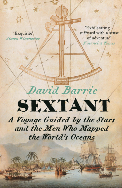
Sextant: A Voyage Guided by the Stars and the Men Who Mapped the World’s Oceans
Настройки чтения
Размер шрифта
Высота строк
Поля
Took a meridian altitude with the sextant – my first. Latitude 43° 17' N.
Colin cooked another excellent stew for supper and we all had some whisky. Everyone cheerful.
Though I was very sleepy, the brilliant light and warmth instantly lifted my spirits. The wind had shifted into the south and we were sailing fast, surging smoothly across the waves rather than crashing through them. At last the decks were dry and we could do without oilskins.
We had crossed the ‘Cold Wall’ that marks the division between the frigid, soupy Labrador Current that pours southwards out of the Arctic and the vast body of crystalline, lapis-lazuli-blue water that surges out of the Gulf of Mexico between Cuba and Florida and sweeps northward off the east coast of the USA. The volume of the Gulf Stream is so huge that it retains its separate character until well out into the Atlantic, and its vital warming influence is felt across the whole of northern Europe.
A hundred yards ahead of us, dozens of shearwaters were diving on a shoal of fish, and suddenly the surface of the water exploded in their midst: for a startled moment I thought a missile had been launched from a submarine. An enormous streamlined shape emerged, rising at least 10 feet in the air. Turning and catching the sun, its flank flashed silver, before it crashed clumsily back into the sea in a colossal shower of spray. I had never seen such an enormous fish – it was a tuna, perhaps half a ton in weight, a seaborne sprinter that could keep pace with a cheetah. The astonishing spectacle lasted only a couple of seconds. Soon the small fry that had attracted the predators had been consumed, and all was still again.
As the sun approached its highest point above the southern horizon, Colin appeared in the main hatch, his silver hair sticking out in all directions, wearing an old guernsey jumper that was full of holes. In his hands was the sextant that had, until now, lain unused in the cabin down below, firmly secured in its square wooden box. Before handing it to me Colin warned me with unusual solemnity never, ever to drop it. ‘Care of the sextant’ was a serious matter: it was a precision instrument and our lives depended on its accuracy. My first lesson in celestial navigation was about to start.
There are many kinds of sextant, and they come in many different sizes – from pocket ones just a few inches across to heavyweight models on a much grander scale. And many materials have been employed in making them, from brass and steel to plastic and even cardboard. The essential design, however, has varied little since the eighteenth century, and a good sextant has the reassuring heft and feel of something really well made. With familiarity comes the recognition that this is an instrument perfectly adapted to its purpose: a solution to a practical problem so elegant and efficient as to be quite simply beautiful. But although I had studied a diagram, the sextant now in my hands was bafflingly unfamiliar. Attached to a triangular black steel frame with a wooden handle on one side were two mirrors, several dark shades, a small telescope and an index arm with a micrometer drum that swung along a silvered arc marked in degrees. Colin showed me how to hold it, with the handle in my right hand and my eye to the telescope.
I had to measure the height of the sun above the horizon just as it reached its highest point in the sky due south of us – as it crossed our meridian. Colin first adjusted the shades on the sextant, then, looking through the telescope, moved the index arm until the sun’s lower edge (or ‘limb’, in astronomical jargon) was more or less on the horizon. I then took his place in the main hatch, braced against the slow roll of the boat, and, gripping the handle firmly, peered tentatively through the telescope at the southern horizon.
Fig 1: Principles of the Meridian Altitude
All I could see at first was a circle divided vertically between a light half and a dark: the left-hand side was the direct view through the plain glass side of the horizon mirror, and the darker right-hand side was the reflected view of the sky above us through the heavily shaded index mirror. Then I found the horizon and, scanning to left and right, caught a glimpse of a brilliant white disc floating just above the dark line of the sea. In a moment it had gone, but then I caught and held it, fascinated to see it moving steadily upwards, the gap between the disc and the horizon widening all the time. It was the sun and I was watching the earth turn.
Fig 2: Diagram illustrating the sun’s varying declination. (G.P. is the geographical position: see Glossary (#litres_trial_promo).)
If I rocked the sextant from side to side, the sun swung in an arc across the sky. By adjusting the micrometer, I brought the disc slowly down until, when the sextant was held vertically, its lower limb was just kissing the horizon. The sun was still moving upwards, but much more slowly now as it neared our meridian. After a minute or two, the white disc paused at the top of its arc. Taking the sextant away from my eye, I looked at the scale and read off the angle: 64° on the main scale and 41 (60 minutes to one degree) on the micrometer. This was the sun’s meridian altitude, or ‘mer alt’.
Colin took the sacred instrument from me and confirmed the reading. I looked up the sun’s declination in the Nautical Almanac and made a few corrections to the observed angle. In a few minutes, to my astonished delight, I completed the simple addition and subtraction sums that yielded our latitude.
We were somewhere on the parallel of 43° 17' North, and – as Colin observed – I was now as well equipped to find my way safely across an ocean as any European mariner before the time of Captain Cook.
Chapter 3 (#ulink_a66a3022-0a2c-5e8e-a595-f946702725f3)
The Origins of the Sextant (#ulink_a66a3022-0a2c-5e8e-a595-f946702725f3)
Day 4: Woken at 0400 and watched a perfect sunrise at 0535. Still reaching a good 5 to 6 knots on course of about 110°. Have covered 330 miles. Beginning to feel very grubby but there’s no fresh water to spare for washing.
Another hot, clear, calm day with wind SSW force 2–3. Passed a bulk cargo ship going the other way. Started reading Slocum
sitting in the sun, then took a nap from 10–12. Then did another mer alt – 42° 58' N.
Our course – approximately 120° magnetic – is meant to take us clear of the Tail of the Bank
where there are likely to be many fishing boats. Slocum sailed on just this route when he set off on his round the world voyage.
Alexa saw some dolphins. I could hear them down below. Everyone in very good spirits.
The heavens have always fascinated people, and we have long looked to them for guidance, though we were not the first animals to do so. Many different species use the sun, moon and stars to help them reach their destinations – whether these are nests a few yards away, or breeding grounds on the other side of the world. The magnificent Monarch butterfly, for example, relies on an internal sun compass to find its way at the end of every summer from the eastern USA south to the mountains of central Mexico where vast numbers pass the winter clinging to the trees. On a more modest scale, dung beetles have recently been shown to use the orientation of the Milky Way to help them roll dung balls back to their nests by the shortest route,
and honeybees use polarized sunlight to navigate to and from their hives on foraging trips.
Mystery still surrounds the exact nature of the homing pigeon’s skills, but they seem to involve a magnetic sense, coupled with a kind of sun compass, and the ability to hear low-frequency sound, such as that produced by the breaking waves that mark the line of the coast.
Some migrating birds rely on Polaris, and seals too can steer by the stars.
Perhaps our pre-human ancestors wondered about the sun, moon and stars before our own species appeared a couple of hundred thousand years ago. Certainly the earliest humans must have realized that most ‘heavenly bodies’ (the old term is irresistible) moved in regular and predictable ways, and that these motions were linked to vitally important seasonal variations in the activities of plants and animals, as well as the length of the days, the weather and the tides. The structures left behind by our prehistoric ancestors present many puzzles but they do at least reveal that their builders had an excellent grasp of the motions of the sun and moon. At dawn on the shortest day of the year (the winter solstice, when the sun stands vertically above the Tropic of Capricorn), the first light still strikes through a carefully placed stone aperture above the entrance to the great passage grave at Newgrange, on the Boyne valley in Ireland. Shooting down a long, low corridor of massive stones it briefly illuminates the burial chamber at the heart of the huge mound. Stonehenge may be a little younger than Newgrange – perhaps only 4,500 years old, rather than 5,200 – but the behaviour of the sun and moon clearly mattered deeply to the designers of this elaborate array of standing stones. The sun on the longest day of the year (the summer solstice, when the sun stands vertically over the Tropic of Cancer) observed from the centre of the stone circle rises just over the top of a single, lonely stone at the perimeter (the Heelstone), as does the full moon closest to the winter solstice.
More recent than these Neolithic monuments, a mere 3,600 years old, is the spectacular Nebra Sky Disc. Illegally excavated in Germany in 1999, and retrieved after an undercover police operation, it seemed at first too good to be true. Many experts feared that the dinner-plate sized object was a fake, but extensive tests have shown that it is genuine. It is perhaps the oldest known visual representation of the cosmos, revealing for the first time that Bronze Age Europeans – like the supposedly more sophisticated inhabitants of ancient Egypt and Mesopotamia – paid close attention not only to the sun and moon, but also the stars. The tight group of seven stars represent the Pleiades as they appeared at that epoch and the Disc may have been used to harmonise the solar and lunar calendars, a process hitherto thought to have been a Babylonian discovery a thousand years after the Disc was made.
Accurate calendars would, of course, have been useful for many purposes such as choosing when best to plant crops, but it is hard to believe that this was the Nebra Sky Disc’s only purpose. Creation myths from around the world offer wildly varied accounts of the origins of the sun, moon and stars and the significance of their behaviour. The extraordinary imaginative energy they display plainly arose from deep concerns about our place in the universe and the meaning of life and death. Such concerns must surely also have influenced the designer of the Disc. It has been suggested that the curved piece of gold at the bottom of the Disc represents a boat – perhaps one that safely carries the sun across the ocean after it has set. It might equally refer to the passage of the soul to the afterlife. We cannot help sensing that this extraordinary object, like the many prehistoric structures that are aligned with the heavens, embodies profound, if mysterious, spiritual beliefs.
Until very recent times the heavens shaped the patterns of everyday life. The farmer judged when to sow his crops by looking at the night sky, and the sun and stars told him the time of day, long before the first mechanical clocks were invented. One of the western portals of the great thirteenth-century cathedral of Amiens in northern France is decorated with the signs of the zodiac, each one accompanied by a depiction of the activities appropriate to the month with which it was associated – such as sowing, reaping, cutting hay and treading grapes. Similar motifs appear on many other medieval buildings. But people did not rely on the heavens only to plan their communal activities; they also thought that the sun, moon and stars could foretell what lay in store for them as individuals or nations. This belief was – and is – so widespread as to qualify as a cultural universal.
The skies were, of course, especially important for sailors. The moon enabled them to predict the height of the tide; ‘full’ and ‘new’ bring the ‘spring’ tides, which have the widest range and produce the strongest currents, while the ‘half’ moon signals the ‘neaps’, with the narrowest and weakest. By day the sun, rising in the east and setting in the west, told mariners roughly which way they were steering, as did Polaris – much more simply – by night. For navigators in the northern hemisphere, the height of Polaris was the crucial measure of latitude – the only one, in fact, until astronomers were able to produce accurate tables of the sun’s varying declination at the end of the fifteenth century.
Fig 3: Diagram illustrating the equivalence of Polaris altitudeand latitude.
As this diagram makes clear, the height of Polaris above the northern horizon is equivalent to the observer’s latitude. Thus if Polaris is vertically overhead, you must be at the geographical North Pole, while if it appears right on the horizon you must be on the equator. In this diagram, its height above the horizon is 50 degrees and it follows that you must be 50 degrees north of the equator – in other words your latitude is 50 degrees North.
So vital was Polaris to the seafarer that the English simply called it ‘the Star’, and Shakespeare knew enough to press it into service in Sonnet 116:
Let me not to the marriage of true minds
Admit impediments. Love is not love
Which alters when it alteration finds,
Or bends with the remover to remove:
O, no! it is an ever-fixèd mark,
That looks on tempests and is never shaken;
It is the star to every wandering bark,
Whose worth’s unknown, although his height be taken …
In medieval Latin, Polaris was Stella Maris – ‘star of the sea’ – a term that was applied also to the Virgin Mary, whose sky-blue cloak is emblazoned with a star in many early European paintings. The theologian Alexander Neckham (1157–1217) likened Mary to the Pole Star standing at ‘the fixed hinge of the turning sky’ by which the sailor at night directs his course. Polaris must have seemed a perfect symbol of the Mother of God, the immaculate spiritual guide and intercessor. The name ‘Stella Maris’ was sometimes also applied to the ship’s steering compass on which the thirty-two ‘points’ are still often marked in the form of a star.
Even today ‘Stella Maris’ is a common name for fishing boats and ‘true north’ – solidly reliable, unlike its variable magnetic cousin – was marked on old charts with a star. (True north marks the direction of the geographical north pole, which is fixed,
whereas the magnetic north pole – like its southern counterpart – wanders and is at present several hundred miles distant from it.)
*
Before the end of the thirteenth century the Venetian explorer Marco Polo recorded that he had measured the altitude of Polaris on the coast of India, though how he did so is unclear. The earliest references to the measurement of the height of Polaris by Portuguese navigators date from the mid-fifteenth century, but it seems unlikely that they were using purpose-built instruments to make their observations.
In theory they could have used the astronomer’s astrolabe, an elaborate device that permitted the observer to find the time of day, as well as solving other astronomical problems. It had by then achieved a high level of sophistication but it is doubtful that many ordinary sailors would have known how to operate one, and such a complicated and costly instrument would not have been required merely for the purpose of measuring the altitudes of heavenly bodies.
A radically simplified version, known as the mariner’s astrolabe, was however widely adopted for use at sea during the sixteenth century,
by which time solar declination tables were available. It was a metal disc or hollow circle with a scale of degrees engraved on its circumference. While it was suspended from its ring, the navigator would adjust the ‘alidade’ (a revolving bar with peep-hole sights) so that it was aligned either with the sun or with Polaris and its height could then be read off from the scale. The motion of the ship, however, and the effects of the wind limited the usefulness of any instrument that had to be freely suspended and it would have been much easier to obtain accurate readings from it on dry land.
Последний отзыв
Да, первый рассказ из сборника, что я успела прочитать, что надо! И написано хорошо, и содержание необычное, но жизненное. Очень понравилось, хотя там...
Далее