Последний отзыв

Книгу прочитать не могу, везде ЛитРес свой нос сунул, как и где скачать полную версию бесплатно!?!?
По всем вопросам обращайтесь на: info@litportal.ru
(©) 2003-2024.
✖


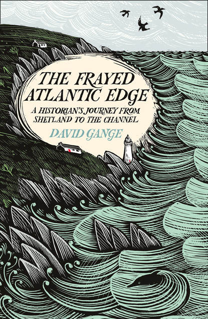
The Frayed Atlantic Edge: A Historian’s Journey from Shetland to the Channel
Автор
Год написания книги
2019
Настройки чтения
Размер шрифта
Высота строк
Поля
Yet each part of Shetland had different ocean-going needs, so the Shetland style developed local variations. From the beginning of the nineteenth century, three things accelerated this divergent evolution. First, the supply of Norwegian kits was interrupted by the Napoleonic Wars, giving Shetlanders new impetus to build for themselves. A generation later, the advent of steamers to the Scottish mainland allowed access to Scotland’s oak and larch, reducing the reliance of this treeless archipelago on Norwegian pine. Between these two changes, the need for vessels more suited to Atlantic conditions became horribly clear: in June 1832, thirty-one boats were wrecked in a sudden storm that lasted five days. A hundred and five fishermen drowned.
Soon there were boatbuilders all over Shetland, experimenting with styles suited to local waters. Of all the islands, Fair Isle – twenty-five miles south of Shetland mainland and twenty-four north of Orkney – maintained Norwegian design features such as the narrow beam and short gunwales most faithfully. Fair Isle craftsmen could rely on tides and isolation to bring enough drift- and wreck-wood to construct much of their yoals. The most specialised and distinctively shaped parts of the boat, however, had to be recycled from old boats into new ones. This explains why Fair Isle vessels were conservative in form.
In the rest of Atlantic Shetland, lightness was slowly sacrificed for ocean-going heft. Adaptation was modest in the south, and more dramatic in the north. At Sumburgh Head (the mainland’s southernmost headland) an extraordinary tidal splurge known as da roost provided excellent fishing, particularly for pollock (called piltocks by Shetlanders). Saithe boats stayed close to shore, but needed to hang on the edge of the tide, controlled by two skilled rowers, while two others ran lines through the racing sea. These boats were shallow and manoeuvrable; each could run da roost more than once a day.
A little further up the Atlantic coast, around the islands of East and West Burra, fishing grounds were sheltered, so there was no need for long, deep or beamy (wide) boats to carry large cargoes on heavy seas. Jetties were rare so boats were dragged up beaches to be kept in noosts (hollows in the ground). Short overland carries could help avoid tidal streams around these small islands and peninsulas. The result was that lightness remained a priority even as boats widened and lost their prancing flex.
The seafaring traditions further north were different. The demands placed on Unst boats grew rapidly after the Napoleonic Wars, partly because of the new confidence and abilities acquired by seamen returning from war, but also due to growing international demand for white fish which swam in grounds so far offshore that, in the words of an eighteenth-century commentator, distance ‘sink[s] the land’. Boatmen began to take the extravagant risks associated with travelling to the edge of the continental shelf and spending nights on the wild fishing grounds known as da haaf. With lines up to three miles long, bristling with a thousand hooks or more, they fished after rowing or sailing thirty to forty miles from home.
The boats that answered these demands were known as sixareens. They were as large and muscular as little wooden rowing boats can get. The width of Norwegian precursors was expanded dramatically, because the new, stupendously long and heavy lines would have dragged a yoal over. Space onboard was such that once lines were laid, fishermen would make a fire in the middle of the boat: they’d light pipes, brew tea, perhaps cook some of the herring caught for ling bait, and pass the time until they began the four-hour task of ‘hailing the lines’. Yet lightness had not been entirely sacrificed: even the most robust sixareen could be carried by its crew of six. Twenty-five to thirty feet from stern to bow, the biggest of these boats was less than double the length of my eighteen-foot kayak. While kayaks are designed to pop back up if submerged and overturned, sixareens were open-topped and undecked. If tipped or swamped they were lost: no one has ever righted a sixareen at sea.
To attempt to comprehend the Shetland experience of the Atlantic I returned to Unst on the first day of really rough weather. By chance, I arrived at the Unst Boat Haven on the same day in July that, 135 years earlier, a storm took fifty lives. Most accounts from survivors of the 1881 storm were chilling but similar word-pictures of still waters turning quickly violent, so that ‘the sea commenced to rain over us’. But one document was different: it asked searching questions about how the characteristics of Shetland sixareens had shaped the tragedy. This text was notes taken in a 1979 interview with Andrew and Danny Anderson who had rowed sixareens in their youth: their father had survived the 1881 storm, but their uncle was killed by it.
I asked a custodian of the Boat Haven, Robert Hughson, whether he knew any more about the family. He recalled Andrew, in his nineties, telling a tale of being caught in sea fog (haa) with his father. As they fished, none of the six on board mentioned the haa or said anything about navigation. But when they completed their tasks, the older men just set to rowing and cruised straight into their noost on Yell. Andrew had a long career as master mariner and captain of one of the first supertankers, but insisted that he never discovered what skill allowed his father’s generation to navigate fog without so much as a compass. Such are the stories the sixareens inspire.
But Andrew wasn’t entirely dewy-eyed for the previous generation of boatmen and boats. In the 1979 interview, he explained why he thought late nineteenth-century changes in sixareen construction magnified the storm’s impact. The heaviest and longest sixareens, he claimed, had lost their key advantage: the lithesomeness of the small Shetland boat. It was impossibly gruelling to prevent these boats being caught side-on to a rough sea. And when a boat plunged into troughs between waves (or ‘seas’ as the brothers always call them), even the best crews lacked time and strength to turn its helm upwards and make it what they called ‘sea loose’ for the next barrage. Andrew and Danny detailed the actions required of boatmen during the phases of a wave; they described main swells forty feet high and the complex action of the intervening lesser swells, as well as how to deal with each. Their imagery is rich: boats reaching messy peaks were ‘running through a sea of milk’. And they detailed the nature of the dangers: a sixareen could take a breaking sea filling it to the gunwales, but failing to clear the boat of water by the next such crest spelled ruin.
Andrew described how in a gale, every captain had a choice. They could raise the sail and run, risking ruin on skerries and being pushed into unsafe landings. On the night of 1881 almost all sixareens took this option because skippers knew they were too heavy to manoeuvre under oar: ten were wrecked. The alternative was what the brothers called ‘laying to’. The smallest sixareen at sea on the night of the storm was the Water Witch, an older boat exactly the same length at the keel as my kayak. This was the only boat whose six oarsmen dared confront the weather. The crew fought a war of attrition with the storm, rowing solidly into the oncoming sea all night to keep the boat from ever yawing side-on to breaking swell. They won a battle with the winds that no other crew could have taken on, and they rowed safely into harbour next morning.
Lying in the path of deep depressions that sweep the Atlantic, Shetland regularly sees beautiful weather for a few short hours, sandwiched between storms and blanket fog: the crew of a sixareen rarely had the luxury of knowing what seas they’d confront. That they risked everything in small wooden craft for modest hauls of fish demonstrates their intrepidness, but also indicates the harsh conditions – both climatic and political – in which islanders often found themselves during times of oppressive governance before the present era of oil-driven affluence. As the Shetlander John Cumming put it,
The boat as transport and fishing tool has shaped so much of Shetland’s history and its culture. We worked the land, true, but all too often a poor, thin land, and in desperate times fishing kept us alive. It made us who we are, a virile, confident, skilled and highly adaptable people with many stories to tell and a unique tongue in which to tell them.
I had assumed, when reading all the admiring writing on the age of the sixareen, that the narrative of Shetland fishing must be one of decline from a golden era when saithe or ling could be plucked from the sea at will, so was surprised to find that the catches of Shetland ships have never been greater than they are today, the technological skill of earlier boatbuilders growing through the age of nets and herring (rather than lines and ling), then steam, motors and engine grease. The question of whether such innovation has been wholly positive – saving lives, but devastating sea life while reducing the number of livings to be made from the sea – is a different matter altogether.
In the serene conditions of the first few days, I felt distinctly un-intrepid, with Shetland’s boating tradition a constant reminder of what humans are capable of when confronting the profound forces of the ocean. I moved slowly on, finding kayaking most pleasurable at night, when winds were lowest and the light dramatic. Between spells of paddling I worked through books I’d picked up in Lerwick, discovering more about the traditions and stories of these islands. Much of this reading was done in the boat, rocking gently on the swell as I rested. Without the splash of constantly rotating paddles, birds and animals often popped up close by, some reacting with surprise but others with curiosity at this bright intrusion in their midst. One gannet appeared within touching distance, allowing me immersion in the infamous ice-blue eye. Like a salt-rimed sea swan, it arched its wings defiantly, but made no sign of moving off. Seated on the waves, the bird’s white tail feathers and black wing tips stretched a surprising distance from its bill (which, slightly hooked, resembled interlocking plates of some long-tarnished metal). Minutes later it launched itself past my bow, bouncing repeatedly on the water and coating my camera lens in sea spray: as elegant as a camel on ice. When I landed, I couldn’t resist a look at the Shetland dialect ‘wird book’ I’d brought along, in case this maritime language had words to evoke things I’d been seeing. To my pleasure, sea spray was brimmastyooch.
It took three leisurely days to pass down Unst then Yell and reach the Shetland mainland. The crossing from Yell to the mainland was the most challenging hour since Unst. With tidal streams running along the sound, around the imposing Ramna Stacks to its south, and then across Fethaland (the finger thrusting out from north mainland), there was no possibility of tackling the whole crossing during the brief slack water between the incoming and outgoing tides. Today, the overnight cloud refused to lift quickly, and a few gusts from the haaf helped amplify my trepidation. But if I had one regret about my paddle down the difficult stretches of Unst and north Yell it was that I’d been too cautious in taking photos: however unsettling it proved to be, I resolved to use my camera even when among the contorted waters at the Stacks (figure 2.4).
The coast of north mainland – the region called Northmavine – is perhaps the most outlandish landscape in Britain: I’d entered a science-fiction vision of an ocean planet. The first headlands, gnarled, grey and viciously gouged by sea, contain some of the oldest rocks in Britain. These soon give way to young red granite pillars and pinnacles, topped with puffins or Arctic terns, which rise directly from the ocean (figure 2.5). Some are smooth and torpedo-like, others prodigiously spiked, and still others have broad bases cut through by arches resembling the galleries of a flooded cathedral. I thought of ‘the living floriations and the leaping arches’ of David Jones’s long poem The Anathemata; in presenting cathedral architecture as an extension of the natural world, Jones insists that nature and culture shouldn’t be seen as separate. Passing through in windless conditions gave me rare access to each dark transept in these enclosed, steep-sided spaces.
These islands are drowned mountains. Six hundred million years ago a vast ‘Caledonian’ range stretched from what is now Norway to the present-day United States. The islands of Shetland were then peaks of Himalayan majesty, before aeons of erosion ground them to their cores. This mountain heritage shapes Shetland’s modern character: the ocean floor falls away from these ‘erosional remnants’ faster than from most of Britain, so that a depth is reached in half a mile that takes a hundred miles to reach from many English shores.
The behaviour of the ocean and the distributions of fish or oil are all defined by those underwater inclines. The first, grey headlands in Northmavine are a rare point at which no remnant of the Caledonian mountains survives, worn down to bedrock laid 3 billion years ago from quartz and feldspar, before laval heat deformed it into the coarse gneiss basement of today. Later, thick sediments settled over this foundation before the clash of continental plates which, through buckling, thrusting and folding, made the Caledonian mountains. When I gazed up at many mainland cliffs, I was staring through cross sections of those ancient hills, with an access to the distant past that is rarely possible from land. The vast variety of rocks – including granite, marble, limestone, gabbro and sandstone – generates the diversity of foliage above. Limestone feeds patches of green munificence, while gneiss and granite starve the ground into blanket bog.
Geological distinctiveness has drawn scientists and artists to Shetland for generations. The driving force behind the great twentieth-century renaissance of Scottish literature, Hugh MacDiarmid, moved here in search of ‘elemental things’, by which he meant old language as well as rocks and the forces that moulded them. In ways that are often neglected, his career was defined by Shetland: it is indicative of the scale of Shetland’s impact on his work that most of pages 385–1,035 in his collected poems were written here. MacDiarmid’s son described the strange scene in their Shetland fisherman’s cottage:
The blazing peat fire, surviving in its grey ashes through the hollow of the night to be fanned fresh with the rising sun, patterned his legs to a tartan-red, and great blisters swelled. But nothing matched the white heat of passionate concentration, the marathon of sleepless nights and days that suddenly ended the sitting around for months indulging in that most deceptive of exercises – thinking.
When MacDiarmid explored these islands – in his own words, ‘rowing about on lonely waters; lying brooding on uninhabited islands’ – he was actually in the company of a geologist (Thomas Robertson) and a fisherman (John Irvine of Saltness). It seems hard to imagine a group better suited to exploring Shetland than these experts in boats, rocks and words. One result of this alliance, MacDiarmid’s long poem ‘On a Raised Beach’, is perhaps the finest evocation of the entanglement of Shetland’s geology, sea and culture ever written. It becomes a kind of metamorphic metaphysical, with a famous opening – ‘All is lithogenesis’ – that rang true as I weaved my way through dramatic features formed from vertical layers of differentially eroded stone. This is a poem that demands to be read aloud, and deliberately snares the reader in thickets of dialect and science: words piled together like stones on the beach.
I dug my MacDiarmid from my dry bag and savoured his insistence that seeing is not enough when we confront Shetland rock:
from optic to haptic and like a blind man run
My fingers over you, arris by arris, burr by burr,
Slickensides, truité, rugas, foveloes
Bringing my aesthesis in vain to bear
An angle-titch to all you corrugations and coigns.
When I reached Ronas Voe, one of the most dramatic sections of this coast, I took a kind of risk I never had before, sleeping at the bottom of tall red cliffs, where a tiny beach of silver-white stones seemed to stretch two yards behind the tide line: just enough space to keep me and my kayak out of ocean. From here, I looked up to Ronas Hill, the highest point in Shetland: a frozen former magma chamber from a huge Caledonian volcano.
Although the days were still fine, this was my first really wet night. Each day so far, I’d stopped kayaking a couple of hours before sleep in the hope of drying out. While at sea, I wear wetsuit boots, neoprene trousers and a thin rash vest that starts out black but after two or three days is mottled silver with salt. Each evening I’d change into warm and comfy land-wear. Sitting back in the sun, with a book by a Shetland author, I’d eat bread and cheese while watching the tides and seabirds pass. But tonight a thin drizzle set in, making the stones of my little beach shiny and slippery.
Rain makes decisions that would otherwise be of little consequence, such as when to change clothes or how to pack the sleeping bag, into significant moments when mistakes can lead to days of discomfort. I had just one set of land clothes (and nothing has ever dried in the hold of a kayak). So tonight, I rushed straight from my kayak gear into the sleeping bag and went to sleep early. Dampness increased as the rain thickened. True to form, my waterproof sleeping bag let nothing in for hours until I was woken by a thin trickle of water rolling down my neck and pooling above my collarbone. I was glad to be sheltered from the wind that had picked up, but decided that the best chance of comfort was to make a very early start.
This was the day I’d reach St Magnus Bay: a bowl in the side of Shetland, fifteen miles across, 140 metres deep and forty miles along the involuted edge I’d paddle. Many of the most dramatic remnants of Shetland’s tumultuous geological past line its circumference. I decided to take my time over the first stage of this journey, passing down the stupendous Eshaness cliffs before landing in a cove at a tiny settlement called Stenness and walking to spend the night on the precipice I’d kayaked beneath. But conditions were slowly changing. Where the sea until today had been a blue-vaulted expanse with perpetual views, the swell had risen overnight to become a series of narrow corridors whose silver walls could obscure even the tallest cliffs. I’d wondered whether I might see basking sharks round Eshaness, but today they could have passed within feet without me knowing. For most of the day, this swell was immensely peaceful, its phases gentle and unthreatening as I moved through four dimensions with every stroke. But at the bottom of the Eshaness cliffs, the swell seemed to come from all directions at once: unpredictable and disorienting. The way to deal with this in a kayak is less about the arms than the hips and thighs. At leisure, I sit straight-ish, but the means of responding to complex seas is to lean forward, lower the centre of gravity and grip the kayak tightly with the knees, creating a sense of connection with the boat. After a damp night and in cold wind, I was deeply reluctant to roll this morning and relieved once I reached the simpler water near Stenness Island. Here I stopped on the swell to take pictures back along the cliffs, as best I could, and to observe the place I found myself: the bowl of another volcano. It felt strangely appropriate that in a spot where I was separated from writhing magma only by time, I should be plunging and leaping with violent swell, head rhythmically plunging beneath where my feet had been.
I landed at Stenness in time for lunch, left my kayak beside an old haaf-fishing station, and began the walk towards the lighthouse to learn these cliffs by watching the setting sunlight shift across them. Before I’d got beyond the bay, the local crofter approached and we discussed the caves along this coast. He insisted I explore the hollow interior of the island known as Dore Holm, rather than just looking up at its huge arch, and told me about a small entrance just north of the Eshaness lighthouse that had been found only a few years ago. It leads, he said, to a huge chamber inside the cliffs. This was my first reminder that apparently timeless and knowable cliffs are mysterious and shifting. There’d soon be many more.
Next day, I continued along the sweep of St Magnus Bay, spending a night that was close to perfection on the cliff-bound island of Muckle Roe. The cove I pulled into through a small gap in the island’s towering crags was as rich in grasses, bog cotton and small flowering plants as anywhere I’d seen. Unsurprisingly, the products of the slow dissolution of contrasting rocks – a wildly varied sward of grasses and flowering plants – appear in Shetland culture almost as much as fish and boats. The star among young poets writing from Shetland today, Jen Hadfield, is particularly attentive to plants of bog and cliff such as the butterwort:
I’ve fallen
to my knees again not five
minutes from home: first,
the boss of Venusian leaves
that look more like they docked
than grew; a sappy nub;
violet bell; the minaret
of purpled bronze.
In ‘The Ambition’ she even dreams of becoming butterwort, lugworm and trilobite, though her ultimate ambition is to be ocean, ‘trussed on the rack of the swell’:
The tide being out, I traipsed through dehydrated eelgrassand the chopped warm salad of the shallows, and thenthe Atlantic breached me part by part.
I sat in this immersive scene and watched Arctic skuas (skootie alan) chase Arctic terns (tirricks) as, in displays of balletic brutality, they forced them to drop their catch or vomit recent meals. And as the air cooled, moths began to clamber up the grasses: after sleepily fumbling upwards they’d shift abruptly, as though at the flick of a switch, into a manic spiral through the evening air.
After Muckle Roe, a long voe leads far inland, ending in the town of Aith. Following the coast now meant plunging into the heart of mainland. Here, I visited Sally Huband – ecologist, nature writer and Shetland-bird surveyor – who made me soup and pizza, as well as providing valuable local knowledge for the next stages of my journey. Sally explained several of the characteristics of Shetland’s wildlife that had struck me as I travelled. She told me, for instance, that the absence of peregrine falcons is partially explained by the dominance of fulmars in their favoured nest sites: when threatened, fulmars spit a thick oil that’s enough to debilitate a peregrine chick or compromise an adult’s flight. Sally had just flown back from the outlying island of Foula where she’d been collecting great-skua pellets as a favour for a friend who needed them before going to Greenland. Her descriptions of Foula’s geological and biological distinctiveness convinced me that once I’d finished my month’s journey south I would have to make my way there: without reaching Foula I couldn’t claim to have travelled Atlantic Shetland.
Back on the water I headed for the mouth of St Magnus Bay, but before I could round the lower lip a large island blocked my route. For any sea kayaker, Papa Stour is the ‘jewel in the crown’ of Shetland: a mile-wide rock with a twenty-two-mile coastline, pocked with some of the deepest and most complex caves and arches in Europe. It is stranded in the ocean amid speeding tides, and I decided to break the journey through them with a night high on the island’s cliffs. I watched a trawler pass the remote Ve Skerries (another ancient knuckle of bedrock) as a group of Arctic skuas clucked and quarrelled like the drunk family at a seaside caravan park.
Papa Stour also appealed to Shetland’s first geologists. In 1819, Samuel Hibbert described his arrival across transparent water, which made the boat appear ‘suspended in mid-air over meadows of yellow, green, or red tangle, glistening with the white shells that clung to their fibres’. He observed ‘red barren stacks of porphyry’ that shot up from the water, ‘scooped by the attrition of the sea into a hundred shapes’. Hibbert described many customs, including the Papa residents’ tradition of trapping seals in the famous caves to club them until ‘the walls of these gloomy recesses are stained with their blood’; but he gives a more picturesque vision of his own journey underground:
The boat … entered a vault involved in gloom, when, turning an angle, the water began to glitter as if it contained in it different gems, and suddenly a burst of day-light broke in upon us, through an irregular opening at the top of the cave. This perforation, not more than twenty yards in its greatest dimensions, served to light up the entrance to a dark and vaulted den, through which the ripples of the swelling tide were, in their passage, converted by Echo, into low and distant murmurs.
Hibbert was a polymath prone to taking long excursions in corduroy breeches and leather gaiters, accompanied by his dog (delightfully named Silly). It was one of these excursions that took him to Shetland in 1817, but his relationship with the islands was transformed when he happened across commercial quantities of chromite on Unst. In 1818 he began a geological survey covering all the archipelago. In the evening or during storms, he would appear at the doors of crofters, seeking bed or food. Then, according to his daughter-in-law, he would ‘retire to rest lying down in his clothes, dry or wet, on a bed of heather or straw, but not always sleeping, for swarms of fleas might lay an interdict on sleep’. On Papa Stour his hosts treated him to tusk fish and ‘cropping moggies’ (spiced cod liver mixed with flour and boiled in the fish’s stomach). Such dainties, he writes, should make Shetland a place of pilgrimages for discerning gourmands. He adds one caveat: for variety the poor islanders sometimes resort to coarse foodstuffs like lobster.
In the morning, I explored the caves, though I couldn’t pass far into their depths, lacking the conditions that Hibbert recommends ‘when the ocean shows no sterner wrinkles than are to be found on the surface of some sheltered lake’. I then swung round the headland beneath St Magnus Bay. Passing under yet more rugged cliffs, I called in on the memory of Vagaland at Westerwick, before embarking on the final stages of my Shetland voyage.
Последний отзыв
Книгу прочитать не могу, везде ЛитРес свой нос сунул, как и где скачать полную версию бесплатно!?!?