Последний отзыв

Отличные тесты, использую р работе как тренер спортивной школы.
По всем вопросам обращайтесь на: info@litportal.ru
(©) 2003-2024.
✖


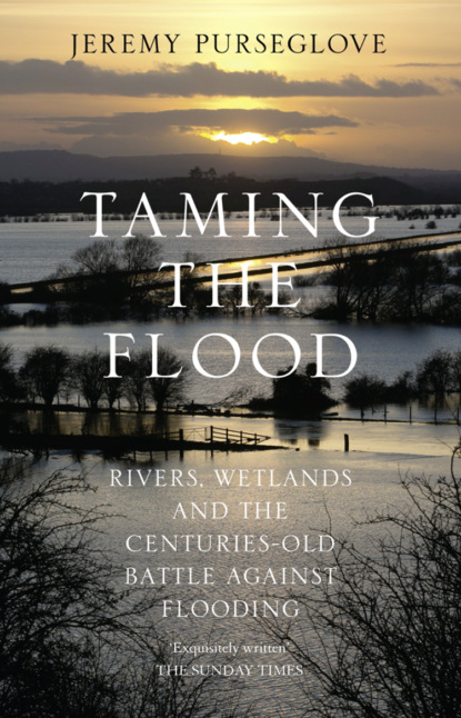
Taming the Flood: Rivers, Wetlands and the Centuries-Old Battle Against Flooding
Настройки чтения
Размер шрифта
Высота строк
Поля
Those pleasant names of places but I leave a sigh behind
While I see the little mouldiwarps hang sweeing to the wind
On the only aged willow that in all the field remains.
The ‘mouldiwarps’, or moles, are the bane of drainage men, since their tunnels play havoc with banks and channels; and even now, water authorities employ mole-catchers. Clare continues:
Inclosure like a Buonaparte let not a thing remain
It levelled every bush and tree and levelled every hill
And hung the moles for traitors—though the brook is running still
It runs a naked stream and chill.
The solitary willow, the gutted brook: these were the things that Clare picked out as the climax of his catalogue of casualties in this, one of his finest poems. How absolutely it chimes with our modern experience of loss of a sense of place. In the mid-1980s, drainage contractors in the Midlands are still moving in on river valleys, starting with the stream itself and then clearing every adjacent hedge and copse as part of the same contract. The only differences Clare would notice are that machines have replaced axes, and that the moles are now gibbeted on barbed-wire fencing.
Clare’s contemporaries in the wetlands had reason to be concerned more for their own survival than that of moles and willow trees. In 1812 James Loch took over as Lord Stafford’s agent at Trentham in Staffordshire. He was later to become notorious as the scourge of Sutherland for his role in the highland clearances. Rather nearer to his employer’s family seat were the marshes of the Wealdmoors, just north of Telford and Wellington in Shropshire, which Loch set about draining with a will. Loch’s reputation in Shropshire does not appear to have been so contentious as it was in Scotland, and the landscape he created in the Wealdmoors is now level ploughland of peat interspersed with rectangular plantations of poplar.
In the Somerset Levels, the surviving nucleus of wetland commons was tackled between 1770 and 1800. The period opened with the usual resistance from the inhabitants, who dug an open grave for William Fairchild, the surveyor of King’s Sedgemoor, and announced ‘a reward of a hogshead of cider … to anyone who could catch him’.
Nevertheless, by 1800 a commoner was speaking with regret of the times when the undrained wastes had given him pasture, where ‘he could turn out his cow and pony, feed his flock of geese and keep his pig’.
Moles, the bane of drainage men, gibbeted on a willow tree as described in John Clare’s poem ‘Remembrances’.
The Somerset Levels. The dwellers of the Levels successfully resisted the kind of large-scale drainage which transformed eastern England in the seventeenth century.
OTMOOR
North-east of Oxford lies Otmoor, four square miles of damp land cradled in a basin of low hills and watered by the river Ray. It is ringed by villages known as the ‘seven towns’, which for centuries were sustained by the rights of common they enjoyed upon Otmoor’s lush pastures. In 1815 an Act for the enclosure of Otmoor was passed, at the instigation of Lord Abingdon and George, duke of Marlborough; and in 1829 the enclosure awards were complete.
Those smallholders who were not directly excluded by the awards lost their shares in the common indirectly, since they were unable to pay the prohibitive legal and fencing costs of securing their small allotments. In 1829 and 1830 the river Ray, which had been subjected to massive engineering works in order to drain the newly enclosed moor, began to flood the land beyond Otmoor. The farmers affected broke up the new flood-banks, and after being arrested initially, were released on the grounds that the enclosure commissioners had exceeded their powers in constructing the drainage works. This was the signal for the general discontent to erupt into action. The dispossessed commoners, invoking the battle-cry ‘Otmoor for Ever’, blackened their faces and went out on to the moor by night to destroy the commissioner’s works. On the night of 6 September 1830, more than 500 of them were out there breaking up bridges, hedges, and ditches. The yeomanry arrived and carted forty-four rioters off to Oxford gaol. By a fatal miscalculation, the guards had chosen the day of St Giles’ fair. An angry crowd attacked the troops, and rescued the prisoners, and their cattle were loosed again upon the common. Only in 1835, after intermittent rioting, subsequently suppressed by the Coldstream Guards, did the magistrates cautiously suggest that unrest had ended, ‘Otmoor, being now it may be hoped in a state of permanent tranquillity’. Vain hope. In the 1970s and 1980s, Otmoor has been the controversial subject of vigorous campaigns fought against both a motorway and an extensive drainage scheme for the river Ray proposed by the Thames Water Authority.
Otmoor and its seven towns before enclosure.
Otmoor after drainage and enclosure.
George Stephenson’s ambitious but never realized plans to embank and reclaim the estuaries in Morecambe Bay.
THE VICTORIAN AGE
Nonetheless, the Otmoor riots mark the end of an era of open conflict on the wetlands. As the Victorian age got under way, ever more ingenious technologies aided the steady advance of drainage. The practice of ‘warping’, whereby tidal waters were made to flow back and deposit their rich silts over the land, was popular.
In 1839 John Rennie put forward proposals to reclaim the whole of the Wash, and to call the new land ‘Victoria County’. Similar megalomaniac schemes were proposed in the 1960s, but were never carried through. In 1837 George Stephenson, who had reason to detest the wetlands after his heroic battle to build a railway across Chat Moss, put forward an ambitious plan to reclaim the whole eastern side of Morecambe Bay by building a railway from Lancaster to Furness. His plan came to nothing, but successive railway engineers were to divert and canalize many miles of river as a by-product of their endeavours. On the credit side, as far as wetland habitat was concerned, where railways crossed valleys, they sometimes disrupted the drainage, creating small marshes which survive to this day. A similar mixed result had attended the efforts of earlier canal engineers. Thus James Brindley set out to drain Longdon Marsh in Worcestershire, and the duke of Bridgewater organized drainage of the northern part of Chat Moss as part of his canal building. More often, however, navigation engineers were at odds with drainage engineers, especially when they were working on existing rivers. To make most rivers navigable, the water level must be raised by building weirs; there is little doubt that the navigation structures built on the Leicestershire Soar in the 1770s worsened the local drainage, as did eighteenth-and nineteenth-century navigation works on the Thames and in Somerset.
The great copper butterfly, now extinct through drainage, depended in its life cycle upon the water dock.
In 1851, which, with symbolic appropriateness, was the year in which a hungry urban population exceeded for the first time the population of the countryside, drainage-minded landlords up from the shires were able to carry away a wealth of interesting ideas from the Great Exhibition. Pipe-tile-making machines were on show, as was a new centrifugal pump which ‘astonished the visitors’.
Within two years, Martin Mere, just south of the Fylde and Whittlesey Mere in the Fens, had been pumped dry.
By the late 1840s the English race of the great copper butterfly, which had retained its last stronghold around Whittlesey, had become extinct.
A symbol of the less controllable results of technology, the Holme Post, a cast-iron column believed by some to have come from the Crystal Palace, was sunk into the ground near Whittlesey, to measure peat shrinkage. Its replacement marker indicates a thirteen-foot drop between the present ground level and that of the mid-nineteenth century.
Technology was to transform not only the actual level of the land, but also the fine details of the wetland landscapes. Extracts from the account book of the Derwent Ings reveal the subtle alterations which took place in the space of two generations:
William Morris. He challenged the Thames Conservancy over their felling of riverside willows. © National Portrait Gallery
A ‘clow’ was a flap-valve to stop flood-water rising back up the ditches at high tide. Leather was no doubt obtained from cattle stocked on the Ings. Nowadays such things are made of steel and rubber.
The 1850s and 1860s, especially after the Land Drainage Act of 1861, saw a steady increase in mopping-up operations. In the 1860s Longdon Marsh in Worcestershire and the Baggy Moor in Shropshire were tackled, as were marshes in the Trent and Tame valleys in Staffordshire. In the 1850s the ‘Bampton Polderland’ on the Thames just south of Kelmscott was drained by an entrepreneurial farmer, William Wood. This still lovely riverine landscape must have been settling down from its major reshaping when William Morris bought Kelmscott Manor in 1871. Morris was no stranger to the environmental impact of river works, as is shown by a confrontation recorded between him and the Thames Conservancy Board concerning riverside willows which they had felled near Hammersmith. Morris resolved to complain to the board, which was composed largely of retired seamen. Feeling increasingly nervous as his appointment drew near, Morris was ushered into a vast boardroom, where the door was flung open by ‘a giant of a man who looked as if he had been fed on rum all his life’:
‘What the hell do you bloody chaps want?’ he roared.
‘What is your bloody business?’
Morris’ shyness disappeared in a flash. ‘We’ve come to ask you savage bloody chaps why the hell you have cut down a pleasant grove of willows.’
THE TWENTIETH CENTURY
Despite the decline in agriculture at the end of the nineteenth century, the tree felling and river clearing continued apace. In the Great War, river clearance was seen as employment for prisoners, and in the 1920s as a way of relieving unemployment generally. In 1922 the chief drainage engineer for the Ministry of Agriculture reflected thus upon the constructive uses to which he had put the heroes home from the trenches:
The real value of the results actually achieved has been a most gratifying surprise to everyone concerned, and it is easy, after the event, to reflect wisely upon the fact that a large percentage of the men must have served a long and painful apprenticeship, whilst on Military Service, to the art of transforming swamps into ‘better ‘oles’.
To supplement the armies of the unemployed, new machines were becoming available. In 1920 the ‘Buckeye’ Ditcher, a bizarre-looking contraption of wheels and pulleys imported from America, arrived at the railway station at St Neots, and was escorted to Croxton Park, where a public demonstration of its capabilities was attended with considerable excitement.
Primitive drag-lines were soon adopted by the richer drainage boards.
Nonetheless, the situation from a drainage point of view was far from satisfactory. Agriculture had been in steady decline since the 1870s, and after a brief post-war boom was to sink back into it again in the 1930s. Two centuries after the ‘blowing’ of the Denver sluice in 1713, the whole security of the south level of the Fens depended solely upon the security of the restored sluice. In 1919 there was little to distinguish the ‘summer grounds’ of large areas of the Somerset Levels from their saturated state a hundred years earlier. To compound the problem, administrative chaos reigned. There was everywhere ‘a chaos of Authorities and an absence of authority’. In 1922 Sidney Webb wrote that the lords of the level of Romney Marsh, who had inspired the founding of the courts of sewers in 1258, still remained unreformed themselves, an ancient relic of pre-statutory local government.
The levying of ‘scots’ on Romney Marsh was discontinued only in 1932, after seven centuries of enforcement. Outworn institutions were to stagger on until, in some cases, the outworn machines and sluices which they maintained also collapsed. In 1940 the old Burwell drainage commission finally accepted voluntary dissolution when its ancient pump engine collapsed beyond repair. In 1929 the Somerset drainage commission went out of existence at the height of a great flood.
The Land Drainage Act of 1918 had made an attempt to simplify the administration of land drainage, but in the late 1920s it was clear that confusion still prevailed. In 1927 the Bledisloe Commission submitted a report which was to form the basis of the 1930 Land Drainage Act, the ground rules of which have dominated land drainage to the present day. Catchment boards were set up, which in 1948 became river boards, and in 1964 river authorities. In 1974 these were incorporated into the water authorities.
The still-vexed issue that the 1930 Act attempted to resolve was who was to pay for drainage.
The courts of sewers, which were abolished in 1930, had always insisted on the principle: no benefit, no rates. The new proposals extended the rating for all works on what is now known as ‘main river’ – the larger watercourses – to the total catchment area. Internal drainage districts (which maintained smaller streams and ditches, especially in the lowlands) were to be funded from within their own areas. The lowlands thus required two sources of income for drainage: one to maintain the main river system, and the second for the back ditches. The householders who lived above the valley bottoms were not happy about paying two sets of rates, needless to say, especially when the towns on the tops of the hills found themselves subsidizing drainage benefits for lowland farmers. The argument put forward by the lowlanders, that they were being flooded out by water sent down to them by those living higher up the hill, was naturally resisted by the latter.
The Denver sluice. Washed out to sea in 1713 and successively rebuilt, it remains the key which controls the floods over the Great Level.
In 1933, following a typical dispute over this issue, Alban Dobson of the Ministry of Agriculture sent a letter to the clerk of the Medway Catchment Board in Maidstone, dictating where the critical cut-off point should lie. This letter, based on expediency and written in a hurry, without any of the proper backing of parliamentary statute, has continued to dictate the terms whereby millions of pounds of public money are spent on land drainage, right up until the mid-1980s. The ministry fixed a cut-off point of eight feet above the known flood-level in all valleys except tidal areas, where five feet was the magic measurement. This has become known as ‘the Medway Letter Line’. All householders living below the line were to be charged a local drainage rate, and this line still dictates the area of jurisdiction of internal drainage boards, whose annual expenditure is considerable and influence on the environment profound. In addition, the Medway Letter Line is the basis for calculating the cost benefit of all schemes carried out on rivers by water authorities and other organizations. As a method for calculating benefit and consequent eligibility for grant, the eight-foot line is, to say the least, haphazard. The concept of ‘known’ flood-level is still vague, and was even vaguer in 1933. The Medway Letter Line was meant to include ‘unknown’ floods, as well as recorded ones, and as information on flooding has become more sophisticated, it can now be seen to have overstated the benefit area by attempting to be on the safe side. In some places the eight-foot line runs along halfway up a hill, and if a valley floor is narrow, it can significantly double the supposed area of benefit. In other places, the line falls below areas which can be said to benefit from improvement. On top of this, the 1930 Land Drainage Act bequeathed a messy and misleading system of raising drainage rates for main-river schemes by precept levied on county and borough councils.
The 1930 Act also opened the way for a new wave of river clearance. In 1954 a paper given at the Institution of Civil Engineers extolling such actions did pause to admit the existence of a peculiarly modern problem:
So much tree clearance work was done during the first ten years of the existence of Catchment Boards that it is now difficult to get a complete picture of the derelict state of the rivers before the passing of the Land Drainage Act in 1930. Unfortunately some of this work was done without a proper appreciation of the fact that the presence of tree growth, and the shade it gave, prevented or at least discouraged the growth of water weeds, the existence of which could form an even greater obstruction than much of the tree growth.
The relatively uncontrolled use of herbicides in the 1950s and 1960s was temporarily to solve that problem. Landowners by the river Soar in Leicestershire confirm the virtual disappearance of bulrush and water-lilies on the river due to spraying in that period.
Последний отзыв
Отличные тесты, использую р работе как тренер спортивной школы.