Последний отзыв

Да, первый рассказ из сборника, что я успела прочитать, что надо! И написано хорошо, и содержание необычное, но жизненное. Очень понравилось, хотя там...
Далее
По всем вопросам обращайтесь на: info@litportal.ru
(©) 2003-2024.
✖


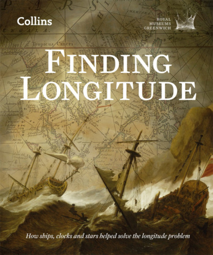
Finding Longitude: How ships, clocks and stars helped solve the longitude problem
Настройки чтения
Размер шрифта
Высота строк
Поля
Remote, unknown waters presented obvious dangers but there were plenty closer to home as well. Indeed, the Royal Navy’s worst maritime disaster of this period occurred not hundreds or thousands of miles away, but off the Isles of Scilly. Having concluded naval operations in the Mediterranean, a fleet under the command of Admiral Sir Cloudesley Shovell set sail for England at the end of September 1707. It should have been a routine voyage in well-known waters, even though they hit gales as they headed home. Just over three weeks in, the Admiral ordered his ships to heave to and check their position, concluding that they were safely in the English Channel. On the evening of 22 October, however, five ships struck the outlying rocks of Scilly (Fig. 15 (#litres_trial_promo)). Within hours four had sunk and at least 1600 men, including Shovell, were dead. It was a national tragedy.
Many causes have been cited: weather; tides and currents; compass error; even longitude. What the surviving log-books show is that variable navigational abilities and unreliable data were the main culprits. The officers’ latitude determinations from backstaff observations, for instance, had an average spread of 25.5 nautical miles (47.2 km), those by dead reckoning a spread of 73 nautical miles (135.2 km). More dangerously, their geographical data was flawed. Most of the fleet took Cape Spartel at the entrance to the Strait of Gibraltar as their point of departure. Its latitude and longitude were listed in manuals such as Colson’s New Seaman’s Kalendar and Seller’s Practical Navigation, but their figures varied widely. Combined with inaccurate charts (see Fig. 11 (#litres_trial_promo)) and generally moderate navigational skills, poor data landed the fleet in its perilous position.
The drive to improve navigational knowledge
The known hazards of the sea and the resulting losses were a spur to improve all aspects of seafaring, including navigation. Among Europe’s maritime states, possible improvements were of obvious interest to those wielding commercial and political power as they sought to strengthen naval and trading operations. As will be seen in Chapter 2, the various rewards offered for longitude solutions from the sixteenth century onwards, and the foundation of state observatories in the seventeenth, arose within this context.
Identical motives lay behind initiatives to improve navigational training. State-backed schools to train and license navigators and pilots engaged in long-distance trade were founded in Spain and Portugal in the fifteenth and sixteenth centuries, and these inspired a number of French navigation schools in the second half of the seventeenth century. Britain was not far behind its rivals when, in 1672, Samuel Pepys, by then Clerk of the Acts of the Navy, led moves to create ‘a Nursery ... of Children to be educated in Mathematicks for the particular Use and Service of Navigacon’.
Granted a charter by Charles II, the Royal Mathematical School at Christ’s Hospital took in forty boys each year, from 1673, to study mathematics and navigation to prepare them for life in the merchant service or Royal Navy.
Significantly, the school had the support of Isaac Newton (1642–1727) and the astronomers John Flamsteed and Edmond Halley (1656–1742), who saw this as a way in which their work could have tangible public benefit. Flamsteed, who taught some of the boys at the Royal Observatory, wrote to Pepys of the school’s value, foreseeing a time when trained seamen would fix longitudes from astronomical observations, ‘whereby the faults of our present Mapps and Sea Charts ... will be corrected and a halfe the Business of navigation perfected’.
Another school initiated in 1712 as part of Greenwich Hospital for Seamen followed similar lines, with pupils first taught (from 1715) by Thomas Weston, assistant to the Astronomer Royal.
Pepys continued his campaign to improve standards after becoming Secretary of the Admiralty. Having observed naval navigation in action, his assessment was scathing:
it is most plain from the confusion all these people are to be in how to make good their accounts (even each man’s with itself) and the nonsensical arguments they would make use of to do it, and disorder they are in about it ... that it is by God Almighty’s providence and great chance and the wideness of the sea that there are not a great many [more] misfortunes and ill chances in Navigation ...
The school solution had been one way to address the problem. Pepys anticipated that, with concerted state support and the help of astronomers and mathematicians, the painful situation he described might be alleviated to the benefit of the nation.
Up until the eighteenth century, longitude determination at sea was one of a number of challenges that faced naval and merchant fleets worldwide. As different nations became the dominant players in maritime affairs, so their political and commercial leaders were willing to give encouragement to anyone offering to solve any of the myriad problems that diminished profits and put lives in danger.
In Britain, the drive to improve navigational knowledge gained impetus as a result of the loss of Admiral Sir Cloudesley Shovell and his men. As an experienced and high-ranking naval officer who knew the dangers only too well, Shovell had had an interest in navigational improvements; for instance, he had met with Isaac Newton in 1699 to examine a proposal for finding longitude put forward by a Monsieur Burden. His death in 1707 alongside so many of his men was a national disaster and, though not solely (if at all) attributable to problems in determining longitude, would be cited in lobbying for a Longitude Act seven years later.
Since there were techniques allowing mariners to navigate with some confidence, one could argue that the measurement of longitude was not an insurmountable problem for them. Nonetheless, it was a practical issue whose solution was felt by some to be within reach and of obvious benefit. For mathematicians, astronomers and cartographers, in particular, it was an intellectual challenge and a practical conundrum in which the peculiarities of being at sea merely hindered elegant mathematical and astronomical solutions. To their way of thinking, here was an arena in which their skills might be called upon in the service of humanity, perhaps earning them fame, fortune and influence in the process. Longitude was a problem for which they believed they might have the answer, and it was they who would put it on the political agenda.
CHAPTER 2 (#ulink_85148956-7036-51bd-b8d3-a1cf86e2c7e4)
THE CONTENDERS (#ulink_85148956-7036-51bd-b8d3-a1cf86e2c7e4)
in the Judgment of Able Mathematicians and Navigators, several Methods have already been Discovered, true in Theory, though very Difficult in Practice ...
‘An Act for Providing a Publick Reward for such Person or Persons as shall Discover the Longitude at Sea’ (1714)
Longitude, as a definable problem that could be separated out from the myriad risks and uncertainties of maritime travel, was of interest to theorists as well as practical navigators. It was, in fact, an issue that advocates of natural and experimental philosophy – what we today call science – latched onto as one for which their approach might be particularly successful. It was clear that finding a solution would be a propaganda coup for the new scientific institutions. It would be irrefutable proof that experimental, observational and mathematical methods, overseen by gentleman philosophers, could be applied to practical issues of importance to national interests.
Within Britain, maritime matters had been a significant focus for the Royal Society of London. That these included tackling longitude was a matter for satire, as in this anonymous poem, ‘In praise of the Choyce company of Philosophers and witts who meet on Wednesdays weekley, at Gresham Colledge’, written in 1661:
The Colledge will the whole world measure,
Which most impossible conclude,
And Navigation make a pleasure
By finding out the longitude.
Every Tarpalling shall then with ease
Sayle any ships to th’ Antipodes.
Fellows of the Royal Society were to play a significant role in the passing of the Longitude Act by the British Parliament in 1714, which was itself to transform the relationship between scientific expertise and the state. It was, however, just the latest in a long line of initiatives to reward anyone able to arrive at workable solutions to the problem.
Longitude rewards
Rulers and states with maritime ambitions who were convinced that the longitude problem could be solved looked for ways to hasten solutions. Their conviction was, it seems, more often the result of lobbying by those likely to gain from financial incentives than a response to calls for assistance from practical seamen. The first such incentive scheme was established in Spain, the leading maritime power of the sixteenth century, by Philip II in 1567. This was followed in 1598 by Philip III’s offer of a reward of 6000 ducats, plus 2000 a year for life – some sixty times the annual income of a labourer – and 1000 towards expenses. The large reward was never paid out but several promising inventions were recognized by the repayment of expenses.
The life-changing size of the rewards on offer, and the fact that workable and complete solutions to the problem were clearly not appearing, led to the whole enterprise being satirized. Cervantes, author of Don Quixote, was one among many over the centuries to mock those who were mad enough to attempt such an impossible task, or who drove themselves mad in its pursuit. He wrote in 1613 of a mathematician who found fixing the longitude like chasing a will-o’-the-wisp:
Two and twenty years I have been employed in finding out the longitude ... and imagining oftentimes, that I have found it, and that it cannot possibly escape me, when I do not in the least suspect it, I find myself as far to seek as ever, which fills me with surprise and astonishment: it is the same with the square of the circle, which I have come so nigh finding out, that I know not, nor can imagine why I have it not at this time in my pocket ...
Finding the longitude – like squaring the circle, creating perpetual motion or predicting the future – was often presented as a fool’s errand. Yet the solutions were, in theory, well understood. What they needed were technical responses to the various challenges thrown up by imperfect astronomical tables and conditions at sea. The answer might, therefore, have seemed tantalizingly close. To nudge them forward, the States General and States of Holland and, less officially, a number of other governments and individuals followed the Spanish example by offering rewards for meeting these challenges. Serious and important ideas were submitted, trials were made and some money paid out.
The Dutch scheme began in 1600 and established a range of rewards, with large one-off sums, annuities and smaller sums for those with promising ideas ready for trial. The top rewards increased over time, with the States of Holland offering 3000 guilders in 1601 and 50,000 in 1738. These sums were sufficiently alluring to attract a steady flow of ideas. There were forty-six submissions between 1600 and 1775, judged by ad hoc committees of theoretical and practical experts, including surveyors, teachers of navigation and university professors. The Dutch East India Company took an interest in the process, reflecting the particular risks and rewards of their trade routes. As with the Spanish reward, a whole range of ideas and solutions was offered, and a number underwent sea trial.
England and France came relatively late to longitude research but their arrival coincided with a period of significant advances in astronomy and instrument-making. Government and royal interest in finding longitude solutions led in both nations to the patronage of individuals with plausible methods, to the theme being taken up by the learned academies – the Royal Society of London and French Académie des Sciences, founded in 1660 and 1666 respectively – and to the establishment of observatories in Paris in 1667 and at Greenwich in 1675.
In terms of both the legislation and the work it was meant to encourage, the passing of the British Longitude Act of 1714 was more a case of continuity than of change. It did, however, come at a time when key successes and initiatives relating to navigation and longitude determination were bearing fruit: several areas of research, with long and sometimes distinguished track records, were earmarked as most likely to lead to success. Given advances in these areas over the preceding decades, there was probably some confidence that at least partial success could be achieved in the not-too-distant future.
The Longitude Act of 1714
If legislators believed that success was imminent, they were encouraged in that view by lobbyists and scientific experts. Their call for a British scheme to echo the Spanish and Dutch was answered on 9 July 1714, when Parliament passed ‘An Act for Providing a Publick Reward for such Person or Persons as shall Discover the Longitude at Sea’. It provided
That the First Author or Authors, Discoverer or Discoverers of any such Method ... shall be Entitled to ... a Reward, or Sum of ten thousand Pounds, if it Determines the said Longitude to One Degree of a great Circle, or Sixty Geographical Miles; to fifteen thousand Pounds, if it Determines the same to Two Thirds of that Distance; and to Twenty thousand Pounds, if it Determines the same to One half of the same Distance ...
The value of this reward, in today’s terms, depends on the yardstick. £20,000 in 1710 can be calculated as worth over £1.5 million early in the twenty-first century, or as a sum that would have paid the annual wages of more than 600 craftsmen in the building trade or bought nearly 5000 cows.
By any measure it was a large amount of money but the Act asked for a great deal: the successful method was to be ‘Tried and found Practicable and Useful at Sea’.
The emphasis on practical utility was underlined by the provision that half of the reward could be given to a method that ensured ‘the Security of Ships within Eighty Geographical Miles of the Shores, which are the Places of the greatest Danger’. However, the full reward was dependent on a successful long-distance sea trial:
Fig. 1 – The opening of ‘An Act for Providing a Publick Reward for such Person or Persons as shall Discover the Longitude at Sea’ (the Longitude Act, 1714)
{Parliamentary Archives, London}
Fig. 2 – Isaac Newton, by Charles Jervas, 1717
{The Royal Society}
when a Ship by the Appointment of the said Commissioners, or the major part of them, shall thereby actually Sail over the Ocean, from Great Britain to any such Port in the West-Indies, as those Commissioners, or the major part of them, shall Choose or Nominate for the Experiment, without Losing their Longitude beyond the Limits before mentioned.
The Act also allowed for the advancement of sums up to £2000 ‘to make Experiment’ of promising schemes. This appears to have meant costs associated with the trial but was later interpreted more broadly by the Commissioners. It was also possible to give rewards to schemes that failed to achieve the desired accuracy, but were nevertheless thought to be ‘of considerable Use to the Publick’.
Perhaps most importantly, the Act appointed the Commissioners of Longitude. They were the Lord High Admiral, or First Commissioner of the Admiralty; the Speaker of the House of Commons; the First Commissioner of the Navy; the First Commissioner of Trade; the Admirals of the Red, White and Blue Squadrons of the Navy; the Master of Trinity House; the President of the Royal Society; the Astronomer Royal; the Savilian, Lucasian and Plumian Professors of Mathematics (the first at Oxford University, the other two at Cambridge); and ten named Members of Parliament. They were not yet a standing body or a ‘Board’, but the Act was significant in creating a group, mostly selected because they held another relevant office, that combined political, navigational and scientific interests. While the President of the Royal Society and university professors had previously acted as advisors, this Act brought philosophers and mathematicians directly into a process of allocating government funds.
When action was being considered in June 1714, it was one of the future Commissioners, Isaac Newton, who presented evidence to a Committee of the House of Commons. He was then President of the Royal Society and, as such, an unofficial advisor to politicians on matters scientific (Fig. 2 (#litres_trial_promo)). He was also working directly on the mathematical and astronomical theories that had potential to help solve the problem. Newton’s written statement noted, in a phrase echoed in the legislation, that ‘there have been several Projects, true in theory but difficult to execute’. He provided a succinct summary of the methods and the problems still surrounding them:
One is by a Watch to keep Time exactly. But, by reason of the motion of a ship, the variation of heat & cold, & the difference of gravity in different Latitudes, such a Watch hath not yet been made.
Последний отзыв
Да, первый рассказ из сборника, что я успела прочитать, что надо! И написано хорошо, и содержание необычное, но жизненное. Очень понравилось, хотя там...
Далее