Последний отзыв
В борьбе за власть есть первые; есть вторые; и есть 6ыдло (из канала BS "Без Слёз").
- Вторые всегда стремятся стать первыми. Но ресурсы власти – у п...
Далее
По всем вопросам обращайтесь на: info@litportal.ru
(©) 2003-2024.
✖


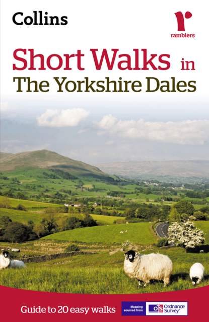
Short walks in the Yorkshire Dales
Автор
Год написания книги
2018
Настройки чтения
Размер шрифта
Высота строк
Поля
Short walks in the Yorkshire Dales
Collins Maps
Recommended for colour tablets only. This ebook is not suitable for reading on black and white eink devices. All content downloaded to device, making maps and text available at all times.The Yorkshire Dales with its picturesque dales, ancient farmhouses and villages offer some superb country walking.This guide, produced in co-operation with the Ramblers and featuring Ordnance Survey mapping, is the perfect way to really appreciate the beautiful Yorkshire Dales.INCLUDES:• 20 easy to follow walks which can be completed in 3 hours and under.• Each walk has a detailed 1:25 000 Ordnance Survey map with the route clearly marked plus a detailed description of the route.• The walks have been chosen with issues like parking and refreshments in mind to make life easy for families.• Packed with colour photographs of scenes you will see along the walk.The perfect guide for afternoon walks near to Sedburgh, Hawes, Settle, Ingleton, Skipton and Harrogate.
Short Walks in
The Yorkshire Dales
Guide to 20 easy walks
Contents
Cover (#u34e91df2-10c1-5dc2-8640-1ebc6a9f3743)
Title (#ud996e335-c4d3-540d-92b9-aee354a9fde4)
Short Walk locations (#ued0f13a3-9f54-5a18-b1de-1d75a749b509)
Introduction (#ubb0f7220-182c-55c5-a9bf-ae32e102f9dd)
How to use this book (#litres_trial_promo)
Short walks
walk 1: Booze (#litres_trial_promo)
3¼ miles (5.2km) (#litres_trial_promo)
walk 2: Muker & Thwaite (#litres_trial_promo)
3 miles (4.8km) (#litres_trial_promo)
walk 3: Semer Water (#litres_trial_promo)
4 miles (6.4km) (#litres_trial_promo)
walk 4: The Waterfalls of Aysgarth & West Burton (#litres_trial_promo)
4¾ miles (7.6km) (#litres_trial_promo)
walk 5: Hardraw Force (#litres_trial_promo)
3½ miles (5.6km) (#litres_trial_promo)
walk 6: Hell Gill (#litres_trial_promo)
4¾ miles (7.6km) (#litres_trial_promo)
walk 7: Winder (#litres_trial_promo)
4¾ miles (7.6km) (#litres_trial_promo)
walk 8: Sedbergh & River Rawthey (#litres_trial_promo)
4½ miles (7.2km) (#litres_trial_promo)
walk 9: Middleham (#litres_trial_promo)
2½ miles (4km) (#litres_trial_promo)
walk 10: Coverdale (#litres_trial_promo)
4½ miles (7.2km) (#litres_trial_promo)
walk 11: Kettlewell & Starbotton (#litres_trial_promo)
5½ miles (8.8km) (#litres_trial_promo)
walk 12: Ghaistrill’s Strid & Grass Wood (#litres_trial_promo)
4½ miles (7.2km) (#litres_trial_promo)
walk 13: Malham Cove & Gordale Scar (#litres_trial_promo)
4¾ miles (7.6km) (#litres_trial_promo)
walk 14: Simon’s Seat (#litres_trial_promo)
4 miles (6.4km) (#litres_trial_promo)
walk 15: Attermire Scar (#litres_trial_promo)
4½ miles (7.2km) (#litres_trial_promo)
walk 16: Pen-y-ghent (#litres_trial_promo)
6 miles (9.7km) (#litres_trial_promo)
walk 17: Upper Littondale (#litres_trial_promo)
5 miles (8km) (#litres_trial_promo)
walk 18: Central Swaledale (#litres_trial_promo)
3 ¾ miles (6km) (#litres_trial_promo)
walk 19: Ingleton’s Waterfalls (#litres_trial_promo)
4¾ miles (7.6km) (#litres_trial_promo)
Другие электронные книги автора Collins Maps


Последний отзыв
В борьбе за власть есть первые; есть вторые; и есть 6ыдло (из канала BS "Без Слёз").
- Вторые всегда стремятся стать первыми. Но ресурсы власти – у п...
Далее