Последний отзыв
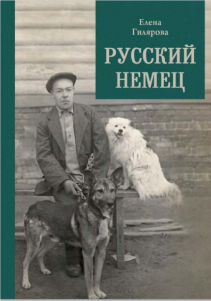
Русский немец

 3.67
3.67
Книга о трагической судьбе бывшего солдата германской армии, который остался в Советской России и в 1922 году женился на учительнице сельской школы. О...
Далее
По всем вопросам обращайтесь на: info@litportal.ru
(©) 2003-2024.
✖


Great Escapes: The story of MI9’s Second World War escape and evasion maps
Настройки чтения
Размер шрифта
Высота строк
Поля
◊ 59 sheets identified with similar numbering
◊ 44 sheets based on Bartholomew maps
◊ 15 sheets use a similar numbering system but not based on Bartholomew mapping
◊ Coverage includes: Europe, Russia, Turkey, Middle East, North and East Africa, Scandinavia, South East Asia
◊ Scales: detailed maps 1:16,000 to 1:600,000 and regional maps 1:1,000,000 to 1:6,000,000
◊ Print dates identified: 7 January 1942 to 9 August 1943
◊ Printed on: tissue, silk, paper, man-made fibre (MMF), rag lithographic paper, bank paper
◊ Bartholomew-based sheets printed largely in three colours: black, red, grey/green
◊ Copies printed: 348,570
For full details of the maps, see Appendix 1.
The existence of a direct link between MI9 and Bartholomew is shown in a company memorandum dated 3 August 1940 from Ian Bartholomew to the company’s London office, on the subject of ‘Captain Clayton Hutton’ indicating that a letter had been received from him thanking them for the prompt attention in sending the plates MI9 had requested. Hutton’s original letter is not in the file. The memorandum indicates that Bartholomew not only handed over printed paper copies of the maps but also provided printing plates for their on-going reproduction. Further confirmation is contained in the first version of Hutton’s memoirs to be published (under a pseudonym) by the inclusion of black and white photographs of two silk maps which can be readily identified as sheets A and C in the MI9 inventory. The link between MI9 and Bartholomew is also confirmed by the existence in a contemporary Air Ministry file of a printed copy of a map which was identifiable as sheet A/Germany carrying a clear imprint of the Bartholomew company.
MI9 added to the maps what passed for a rather crude sheet identification system in the form of an upper case alphabet letter, often in conjunction with an Arabic number (for example C, H2, K3). However, even this practice was not consistent as the same numbering system was also applied to some sheets which were clearly not based on the Bartholomew small-scale maps. The largescale sheet of the port of Danzig (A4) at approximately 1:16,000, the large-scale map of Schaffhausen (A6) and the medium scale sheets of Italy (J5 and J6 at 1:275,000, J7 and J8 at 1:110,000) are six such examples. Sheet A4 Danzig appears to be an amalgam of the detail from a British Admiralty chart with additional ground intelligence added in the form of intelligence annotations. (This particular map will be discussed in more detail in Chapter 7.) Sheet A6 of Schaffhausen is based on large-scale, native German and Swiss topographic maps of the border area and sheets J5, J6, J7 and J8 appear to be based on large-scale, native Italian topographic maps. For the purposes of this study, however, they have been identified as one series based on the similarity of the sheet numbering system. Certainly it appears that the first small-scale map of the area was identified with a single alphabet letter, such as A, and that any subsequent map produced which was located in the same geographic area was numbered A1, A2, etc. in sequence. To prove that this was, indeed, the approach adopted would assume that, since sheets J5 to J8 all provided large-scale coverage of the Italian area, sheet J should be a small-scale sheet of Italy. This cannot, however, be proved conclusively, since no copy of sheet J has yet been found and no mention of it appears in the record.
Due to the nature of the fabrics used, the ink often bled completely through to the reverse of the sheet, as shown here with Bartholomew sheet A. Many of the maps were still printed on both sides however, making it very difficult for the escapers to decipher the detail.
Details from a selection of Bartholomew maps showing their symbology, level of detail, density of place names and scale information. They also show the problems for the user caused by show-through from the map printed on the other side of the fabric.
A further map included in this series (but which had no identifying letter) was a General Map of Ireland, produced in two sheets, printed back-to-back. This was almost certainly the map mentioned in the records as ‘Shamrock’, 500 copies being printed on fabric on 16 February 1942. There was apparently some discussion about the position of internees in the Republic of Ireland since, under the Geneva Convention, internees were held until the end of the conflict. On 5 March 1943, in a MOST SECRET internal minute from MI9 to the Director of Intelligence, a discussion between Sir John Maffey, the British representative in Eire, and the Irish Government was reported. It concerned the possibility of faking the escape of British prisoners of war interned in the Curragh. The deal fell through, apparently because the Irish Government wanted fighter aircraft in exchange. Whether the internees might be encouraged to escape anyway was a moot point since there was the distinct possibility of political embarrassment. The fact that the General Map of Ireland was produced at all appears to bear testimony to the fact that MI9 prepared for the possibility of escape and it was certainly recorded in the War Diary that nine RAF officers escaped from the Curragh Camp in Eire on 25 June 1941. Three were recaptured and six reached England. MI9 apparently wrote a special SECRET report on the escape, but this has not been identified.
Those sheets where surviving copies have been located in British record repositories and the various states in which the sheets were produced, either singly or in combination, are detailed in Appendix 1. A total of fifty-nine sheets have been identified in this initial group of the escape and evasion maps, of which over forty are clearly based on Bartholomew maps. Some of these carry the original Bartholomew job order number which has allowed them to be compared directly with the lithographic paper copy held in the company’s print archive now housed in the National Library of Scotland’s map collection in Edinburgh. Sixteen sheets which are believed to have been produced but for which no copies have been identified to date in British record repositories are listed in Appendix 2. This group is either noted on the print records, shown on adjacent sheets diagrams, represents gaps in the assumed consecutive numbering sequence or, in one case, has been spotted by a colleague at a map fair but no details were recorded.
Summary of fabric maps presumed to be based on Bartholomew originals
◊ These are maps which are assumed to have been produced based on Bartholomew maps but for which neither copies nor related records have ever been found
◊ 16 sheets identified
◊ Coverage includes Europe, Scandinavia and parts of Africa
For full details of the maps, see Appendix 2.
By autumn 1942, there was an increasing awareness that the small-scale maps being issued to aircrew were regarded by them as too small-scale. The need for better maps at larger scales gained momentum and ‘a new series gained approval’. It is not clear what this new series was, but it is likely to have been the fabric versions of series GSGS 3982 (see the following section), as they started to be produced at that time, their earliest print dates being the late summer and autumn of 1942. At this stage valuable information about the Swiss frontier was also being incorporated into a map of the frontier area produced at 1:100,000 scale.
Double-sided Bartholomew sheet K3/K4. The nature of the fabrics used for MI9 maps allowed them to be folded into very small sizes.
EUROPE AIR 1:500,000 GSGS 3982 [FABRIC]
Despite the evidence indicating that MI9 engaged initially with commercial companies to develop and progress the escape and evasion mapping programme, there was clearly contact with the operational map-makers at some stage since any map series carrying a GSGS series number is immediately identifiable as an operational series. This group of escape and evasion maps was produced by reducing the original operational Europe Air series from 1:250,000 scale to 1:500,000 scale. This reduction could only have been done from the original reproduction materials which would have been held by D.Survey since, apart from their scale and print medium, they are identical in all respects to the original lithographic paper maps.
Summary of Europe Air 1:500,000 GSGS 3982 [Fabric]
◊ 74 sheets identified
◊ 4 additional irregular sheets, based on Arnhem (‘Dutch Girl’); Sections 1, 2, 3, 4
◊ Coverage: Europe (see cover diagram opposite)
◊ Scale: 1:500,000; sheet N33/9 at 1:375,000; Arnhem maps at 1:420,000
◊ Print dates identified: June 1942 to August 1944
◊ Printed on: fabric, tissue, paper, mulberry leaf substitute (MLS), mulberry leaf (ML) tissue
◊ Printed in six colours
◊ Copies printed: 35,100 plus 8,221 Arnhem maps
For full details of the maps, see Appendix 3.
Cover diagram of the Europe Air 1:500,000 GSGS 3982 [Fabric].
As a result of the scale reduction, the escape and evasion maps were one quarter the size of the original operational lithographic maps printed on paper. These maps were variously referred to as ‘miniatures’ or ‘handkerchief’ maps (while no confirmation of this description has been found in the records, it carries the ring of authenticity because of the small size of the maps and their reduced scale). The sheets were printed in six colours and individual sheet coverage is two degrees of longitude (°E) and one degree of latitude (°N). All geographical values of the extent and coverage of individual sheets have been derived from an index of the original series acquired from the Defence Geographic Centre (DGC). This index has also been used as the basis of the cover diagram shown on page 61.
Turin, Europe Air 1:500,000 GSGS 3982 [Fabric], sheet L32/7.
Detail from this sheet, clearly showing the borders of Switzerland, France and Italy.
Escape and evasion versions of some seventy-four sheets were produced. Over 35,000 copies were printed between 10 July 1942, when production apparently commenced, and an unrecorded day in July/August 1944, when the decision was taken to cease production. One can therefore conjecture that MI9’s contact with D.Survey, either directly or using the Ministry of Supply as an intermediary, had started at least by mid-1942. Despite the significant number of copies produced, relatively few surviving sheets have been discovered. This may reflect the fact that many of the print runs were very small, 45 and 100 being common.
The sheets in this series were produced sometimes singly and sometimes in combination, although it has not proved possible to identify from the records the various combinations which were produced. They were produced on fabric or paper, the latter being variously described in the print record as ‘RL’, an acknowledged abbreviation for rag lithographic paper, ‘thin BANK paper’, ML (Mulberry Leaf) or MLS (Mulberry Leaf Substitute). One interesting group of a block of four of these sheets was produced under the codeword ‘Dutch Girl’. They are centred on Arnhem and are of non-standard geographical extent, location and scale, being 1 inch to 6.56 miles or approximately 1:420,000; as a result they are referred to in the record as Sections 1, 2, 3 and 4. The record shows that some 4,400 copies of these four sheets were produced in June 1942 and were described by Hutton in earlier correspondence with Waddington as ‘a very, very urgent requirement’. The purpose of producing these sheets at that stage is not clear, although it might have related to the combined operations which took place at that time and are known to have involved Section X of MI9 and the Special Operations Executive (SOE). In all probability, the subsequent printing of the same sheets, which took place in the period prior to August 1944, was in timely support of the Battle of Arnhem, otherwise referred to as Operation Market Garden, which took place in September 1944.
NORWAY 1:100,000 GSGS 4090 [FABRIC]
Once again MI9 must have acquired access to the reproduction material of another operational map series produced by D.Survey. Thirty-three sheets of this pre-war GSGS series of Norway at 1:100,000 scale were printed on silk, apparently for escape and evasion purposes, in 1942. The sheets are located in a block to the north of Oslo and adjacent to the Swedish border. Thirty-one sheets are monochrome, based on the 1940 state of the original GSGS 4090 sheets, while two sheets (26B and 26D) are printed in four colours (black, red, brown, blue) and are based on the 1942 revision of the GSGS 4090 sheets. The original lithographic paper maps were based directly on original native Norwegian maps, some of which dated back to the early years of the twentieth century. The original Norwegian maps were based on the Oslo meridian. The GSGS series maps, therefore, carry a conversion note to the effect that the Oslo meridian is 10° 43' 23" E of Greenwich.
Extract from the marginalia of sheet 19D, showing the scale bars and the instructions on how to convert geographical coordinates from the Oslo meridian to the Greenwich meridian.
Summary of Norway 1:100,000 GSGS 4090 [Fabric]
◊ 33 sheets identified
◊ All sheets single-sided
◊ Coverage: Norway north of Oslo and adjacent to Swedish border
◊ Scale: 1:100,000
◊ Print dates identified: 1942
Последний отзыв
Русский немец
3.67
Книга о трагической судьбе бывшего солдата германской армии, который остался в Советской России и в 1922 году женился на учительнице сельской школы. О...
Далее