По всем вопросам обращайтесь на: info@litportal.ru
(©) 2003-2024.
✖


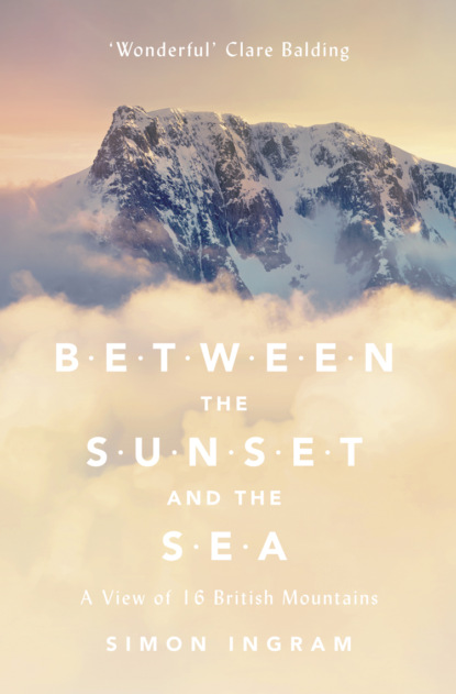
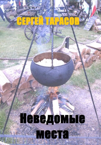
Between the Sunset and the Sea: A View of 16 British Mountains
Настройки чтения
Размер шрифта
Высота строк
Поля
The only other thing you need to know about me is that I’m probably just like you – that is, if you’re the sort of person who finds themselves gazing at mountains with a bit of a happily confused look on their face. Like many touched by this strange infatuation, mountains had become a big part of my life, even becoming my job in a meaningful way, as since that day in Torridon my days had been spent working for an outdoors magazine – something that put me thoroughly in touch with the physical process of climbing Britain’s mountains. I’d seen a lot, and I’d certainly learned a lot, but I’d come to realise more and more that walking to the tops of mountains was only the first step towards really getting under their skin.
And the thing is, I still wasn’t very good it. No matter how much I tried to be one of those people who could negotiate the pratfalls of equipment, navigation, physical prowess and danger with Buddha-like calm, I just wasn’t someone to whom mountain climbing came as an easy, natural fit. It took constant effort to appear even remotely competent. I forgot things. I still got lost, having a knack for losing even well-trodden paths from beneath my feet – a trait that over the years has left companions initially amused, then bewildered, then genuinely concerned there was something medical at play. And despite ten years of exposure to it, a neuro-linguistic programming course to help me overcome it, and more moments of pause than I care to recall, I was host to a concentrated – and worsening – fear of heights.
But I loved it. I absolutely loved it, in that kind of unconditional, permanent way you know you’ll be stuck with until you croak. I’d felt it slowly maturing behind the scenes over the years. It wasn’t an obsession – obsessions with mountains rarely have happy endings – and it wasn’t anything to do with ambition. I genuinely just wanted to linger in, loiter on and explore the mountains – and experience just being in these uniquely atmospheric places.
And now I was going back to where it began for me, to take the tentative first steps on another quite different mountain journey.
Over time the idea that you could gather together a small clutch of the most singularly extraordinary of the British mountains had become increasingly distracting to me. This would be a journey in search of one simple thing: what makes them extraordinary. For some of these mountains, the most amazing thing about them might be the violent voyage through time they’ve taken to get here. For others, the tales of science, endeavour and art that have played out on their slopes. The mythology they’re drenched in. The history they’ve seen. The genius they’ve inspired. The danger that draws people to them. The life that clusters around them, human or otherwise. The extreme weather they conjure. The adventure they fuel. The way that some raise the hairs on the back of your neck and trigger powerful, strange emotions. And moreover, what they’re like to be amidst, under, on – just what that indefinable quality is that the British mountains wield that takes possession of you so powerfully, and never goes away. Were you to find one mountain that best exemplifies a particular one of these conditions – a kind of natural temple to each – in a way, they would collectively comprise a kind of ultimate summit bagger’s list. Something achievable but definitive: a collective interpretation of the British mountains.
All mountains are different, of course. If you were to seek an example of every unique quality they possess the list would easily run to a thousand. But what my list would provide was a kind of experiential mountain hit list for people who don’t have the time or will to climb a thousand of them. A list that, were someone to ask you which British mountains they should climb – and you could only pick a dozen, say – would make a pretty impressive answer. This wasn’t just a ten highest, a twenty prettiest or a thirty most likely to make you shriek; it was something much more subtle and infinitely more interesting. Although I didn’t really yet know it, it would be a journey that would take over a year, and take me high into the rafters of Britain’s most forbidding, unflinching and unchanging wild places through all seasons – from the first blush of spring to the deepest, darkest bite of the mountain winter. A journey that, as it turned out, would have sixteen separate destinations. And Beinn Dearg, towards which I was driving in the slanted light of this autumnal afternoon, was the first.
The harmonic buzz of a deer grid beneath car tyres and a rinse of static over the radio accompanied my arrival into the long, broad scoop of Glen Torridon. To the right, stands of skeletal trees, their bark dead and grey, lined the lower slopes of Beinn Eighe – a monster of quartzite mountainside dominating the northern side of the glen for several miles. Its back is turned from this angle; you can’t see the drops, the falling arêtes, the dark gullies, the hidden valleys. As the beautiful sea loch that gives the glen its name approached, I began to feel myself moving from one realm to another as the radio weakened further, mobile phone reception died, and above me, the mountains of Torridon sharpened.
Cheerily weather-beaten, the houses of Torridon village cling to a single street between the water of the loch and the bottom of another mountain, Liathach. Liathach is long and tall, but tilted away from the road, like a mainsail in a crosswind. Like Beinn Eighe, all you see from the road is a languid slope, cut by rivulets of meltwater; hidden is the 800-metre fall of the north face, which the map assures us is there but which the eye cannot see from this vantage point. Like Glen Coe, there’s only a certain appreciation you can have from a car. The rest you have to earn by foot.
Beyond the village, I found the small car park amongst the woods of Inveralligin, where I’d parked with Tom in 2004. From here a twiggy path led along a series of waterfalls, turns and climbs, then broke out of the trees, following the river earnestly towards the mountains that fed it. Ahead, the outline of Beinn Dearg began to crisp into focus, from this perspective angular, almost trapezoidal. It looked interesting. It also looked weirdly unfamiliar, and it was only as the mountain’s broad base approached that I realised just how much I’d forgotten about the ascent. Last time, I was just being introduced by someone else to this place. I was a tourist. Now, alone, I was in charge.
I’d chosen Beinn Dearg as the first mountain in this little quest for several reasons. The first was that it was a mountain that exhibited the feeling of exposure – of raw height – to a spectacular degree. There are taller and steeper mountains, not just in Britain but in this immediate area, that could easily compete; but Beinn Dearg to me was the finest example, not least because it delivers in such an unexpectedly dramatic fashion.
How a mountain cuts its dash is, of course, down to its geology. The Torridon mountains, with the exception of Beinn Eighe – which, thanks to the convoluted mangling of British upland rock eschews the typical Torridonian sandstone top for a cap of crumbling white quartzite – have a particularly unsubtle way of climbing to their considerable elevations. Laddered with horizontal terraces of crags, glaciation and weathering have sculpted the flanks of these peaks into a distinctively consistent form: as they climb, they rise first steeply, then vertically, then steeply, then vertically. From high on the mountain, the experience of looking down this sloping-step structure is devastating: beyond tipped, slippery slopes of grass and loose rock, drops open. And these are big, convex drops, whose extent is hidden. It makes you feel like you’re sailing towards the edge of a waterfall.
The result is a stepped wall of mountain through which passage has to be found before you can stand on the top. In England, Wales and the higher, more travelled mountains of Scotland, many of these ways have been engineered, or walked so many times they are worn unambiguously into the mountainside. On Beinn Dearg, there are no such ways. Every side of the mountain is steep and outwardly impenetrable, and the way up is not obvious.
I was aiming to climb the mountain the same way as before as I was fairly sure it was the only realistic way up. But whilst I’d in effect be repeating my earlier ascent, I wouldn’t be repeating the weather – and that made a difference. Even a subtle shift in conditions can completely change a mountain’s character, and today’s mizzle was far from a subtle shift.
Down to the left of the path the river was surging. I could hear the hard ‘clock’ of boulders being spun and punched along its bed. Crossing it would be impossible on foot. Luckily, the last human augmentation to the landscape before the Bealach a’ Chòmhla – the high gap or bealach between Beinn Dearg and its tall, sheer neighbour, Beinn Alligin – is a bridge. Beyond, as the path’s thin ribbon began to climb, it started to rain. I looked up towards Beinn Dearg’s south-west face. Though the detail of its buttresses was softening in the drizzle, I could still see clearly what lay ahead. It looked so high, and steep: impossibly steep. I’d been up it before, and had no recollection of it being that difficult. Maybe distance would decode it; perspective in the mountains was tricksy, after all. Perhaps at the foot of the slope it would cease to resemble a wall and take on a kinder angle. As eyelash-hung raindrops began to quiver the mountain in my vision, I stooped my head and continued on, the soft gnaw of apprehension in my stomach.
As I got closer, the tiny grains of scree that hung around the lower slopes of the mountain like a valance grew into boulders, some the size of marrows, others the size of cars, the odd one the size of a house. A flicker of memory: had I climbed through this before? I scanned above, tracing a potential line of travel through the boulders onto the grassy shoulders and up, up onto the sharp skyline of the north-west ridge. Possibly. Possibly that would go.
The boulders were chaotically tall and grey, the grey of the cindered ruins of a bombed-out town. The sandstone was sharp and cold, the hard fabric of my trousers and jacket making a scratching sound as I brushed by. All of this must have fallen off the mountain at some point; what a terror it would be to see one of these boulders racing down this face. For the first time on this mountain, my hands touched rock. Using your whole body to move through terrain is less tiring than just using your legs, as well as being more engaging to the brain. Of course, it’s usually steeper, too – which has the benefit of gathering height beneath you briskly, although it quite literally has a down side. I found myself enjoying the crossing of the boulder field so much that I forgot to keep an eye on the drop opening quickly behind me. It was only when the ground underfoot pitched enough to give me a thoughtful moment that I noticed the features I’d passed were taking on the altered perspective that only comes from being several hundred feet above them. Streams and stodgy bogs were suddenly sinuous rivulets and sky-mirrored pools interlocking with a messy elegance. I refocused upwards. Looking along the edge of the mountain, I could see that I was approaching a band of crags – the first of several that ran laterally across the mountain like taut waist-belts. After the ease of the boulder field, the way ahead was all of a sudden daunting. This was where things got interesting. This was where the mountain began.
What constitutes the ‘special quality’ of the British mountains is a big question, but it’s one worth asking. To engender such wide-ranging respect and affection – and they do, as we shall see – whatever it is, they must have it in spades. And it certainly isn’t height; not height in the numerical sense, anyway.
First, though, there’s the matter of exactly what qualifies as a mountain. People argue all the time about this. They kick numbers around, use terms like ‘prominence’ and ‘relative height’, quibble over a metre here, a foot there, and get sniffy about certain hills because they don’t hit a certain all-important benchmark. But in my book – and this is my book – it’s all a bit unnecessary. Mountains were never meant to be specific; they’re chaotic, and all about feeling and aesthetics. If it looks like a mountain and it feels like a mountain, then it is a mountain.
This is a convenient viewpoint to take, as a proper definition doesn’t actually exist – neither between a mountain and level ground, nor between a hill and a mountain. The Collins English Dictionary (and I should probably underline here that it’s no worse than any other dictionary in this regard) defines a mountain as ‘higher and steeper than a hill and often having a rocky summit’, and a hill as being ‘a natural elevation of the earth’s surface, less high or craggy than a mountain’. The only thing that seems to be agreed is essentially a loose compositional contrast – mountains are rockier and higher than hills, hills are rounded and lower than mountains – but no specifics as to what extent or with what steepness something has to project from the earth’s surface in order to be classified as one or the other.
If this were an accepted grey area things would be fine, but it isn’t; many still think mountains and hills differ from each other simply because of their height. In September 2008, three amateur surveyors re-measured a mountain in North Wales – Mynydd Graig Goch, in Snowdonia – and found its height to be 2,000 feet, rather than 1,998 feet. The celebratory headlines that followed certainly suggested this constituted the crossing of a significant watermark; the BBC report of 19 September – in a similar vein to many others of the same day – was a simply triumphant ‘Survey turns hill into mountain’. So there is clearly a school of thought sufficiently established to make national news that the appropriate point at which a hill ends and a mountain begins is 2,000 feet – or 609.6 metres. In a pernickity sidenote, many of these reports drew parallels to the 1995 film The Englishman Who Went up a Hill But Came Down a Mountain, whilst quietly ignoring the fact that in this instance (based on a true story and a real eminence – The Garth, near Cardiff) the point where a hill became a mountain was only 1,000 feet.
Either way, and however wonderful both stories were, they get us no closer to a definition. There are many sharp, craggy elevations below 2,000 feet – or even 1,000 feet – that certainly resemble and evoke the idea of a mountain, just as there are plenty over 2,000 feet and 3,000 feet that struggle to resemble the definition of a hill, let alone a mountain. This merely serves to highlight that all these places are different and defy any kind of numerical ring-fencing: a mountain is simply what is made in the eye of the beholder. The pioneer Scottish mountaineer J. H. B. Bell put it rather nicely when he wrote, ‘Whether we are dealing with the little 1,000-foot hill near our homes … or a 20,000-foot giant of the Himalaya … in certain kinds of weather and atmospheric lighting, one can look almost as impressive as the other.’
What we do have instead are classifications – lists, basically – which are less definitions and more ways of grouping the natural shambles of mountains together under something approaching order.
It’s testimony to the fascination of Britain’s high places how many of these lists there are – especially since the presence of mountains does not necessarily an overwhelmingly mountainous country make. Most of Britain’s high places are isolated in ranges in North or South Wales, the Lake District and Pennines of England, and the Uplands, Highlands and Islands of Scotland. Yet despite this fairly lean coverage, Britain is far from short of mountain classifications – many of which, whilst inevitably overlapping to a degree, comprise hundreds of mountains. Amongst others we have the Deweys, Tumps, Hardys, Nuttalls, Donalds, Grahams, Murdos, Corbetts, Wainwrights – and, most venerable of all, the Munros.
If this all seems a bit tedious, don’t worry. We’ll revisit one or two of these lists, but most of them we won’t. And either way, it doesn’t really matter.
Another thing that doesn’t seem to matter is absolute elevation. On paper, the mountains of Britain are – relatively, at least – embarrassingly slight. Not a single one gets remotely close to cracking the 2,000-metre mark, which, as I understand it, is the minimum height a mountain has to be before a French mountaineer can justify the energy required to look up at it. There are car dealerships in Italy higher than the 1,344-metre (4,409-foot) summit of Ben Nevis. The million people who inhabit Guatemala City live, sleep and work higher than our highest point and probably don’t have to do it in a Gore-Tex coat and walking boots. In fact most countries in the world have enough justification to – in the most literal sense – look down on the height of Britain’s modest mountains. Amongst the many, many countries that boast far higher peaks than ours within their borders are the less-than-notably mountaineering nations of Cuba, Guinea, Sri Lanka and Madagascar – with Fiji, Tonga and the Seychelles uncomfortably close to joining that list.
But despite their diminutiveness, people come from all over the world to get our mountains beneath their feet. Many are world famous, and – whilst perhaps not as ballistic or notorious as, say, the Matterhorn or the Eiger – the shadows they throw are far longer than their physical statistics would seem to merit. Perhaps it’s the convenient conservativeness of their height; they’re robust enough to feel big and tall enough to include several distinct ecosystems, but none of them requires more than a day to get up, or hits any altitudes that require acclimatisation. This makes our mountains extraordinarily inclusive, which is further helped by the fact that few require the assistance of a rope to achieve the summit. Given even a basic skill set and fitness, and the willingness to use your hands, outside of winter most people can get to the top of most British peaks under their own steam. Indeed, most host routes to suit all abilities to such a canny degree it’s as if this were a conscious consideration in their design.
Not that they always look straightforward, of course. An amusing story, which time has sadly rendered apocryphal, concerns a visitor from Switzerland who had come to walk up Snowdon. Upon rounding a corner of the Pyg Track, at a point that offers a spectacular view of the mountain’s east face, he froze, before imploring his party to turn back as there was insufficient daylight to make a summit attempt. Snowdon had tricked him; in good conditions the summit from that point is little more than two hours away. This is heartening, because, if you’ve ever seen the Swiss Alps, you’ll know that the mountains there are ridiculous. They’re like daggers, and there are millions of them. The fact that someone who comes from a country with mountains like that would want to come and climb one of ours – let alone be overawed by one – tells us something. It tells us ‘less is more’. It also tells us that whatever it is our mountains have, it isn’t cheapened by abundance or the anonymity of youth. They are dignified. Distinguished. They have something, which, were they alive, you might call a personality.
The names help. Oh, the names. Mountains across the world are usually given evocative names; it’s what comes of being the landscape’s most dramatic natural feature. But the toponymy – a little-deployed word to do with the etymology of place names – of the British mountains has a curiously unique vintage that is both cherishable and maddening, depending on the dexterity of your pronunciation muscles. Thanks to the interbreeding of Middle English, Gaelic, Goidelic Celtic, Old Norse, Anglo-Norman and the odd humorous landlord with a hill’s identity at his disposal, we have within our shores mountains that sound like flaking skin conditions (Slioch); someone choking on a Polo whilst trying to give directions in a Glasgow suburb (Stùc a’ Choire Dhuibh Bhig); unpleasant bodily reflexes (Barf); embarrassing bodily parts (Fan y Bîg); a kind of rice-based snack (Canisp); and the fortress of some medieval villain (Bidean nam Bian). We also have a couple of Cockups (one big, one not so big), a Sergeant, several Old Mans and literally hundreds of Bens. And though I jest, the meanings of some of the more colourful mountain names are as fascinating as they are eclectic. To illustrate this point, I’ll offer just one particularly good example: a hill in North Wales called Pen Llithrig y Wrach. It means ‘Hill of the Slippery Witch’. How can you not love that?
Not all hill names are unique, alas. There are several Beinn Deargs, for instance. It means ‘Red Hill’, and it’s a lazy name, about as plain as you can get for a Scottish mountain. Beinn is a typical Scottish Gaelic word for a peak, or hill. The ‘red’ is probably a reference to the way it looks in a certain light at a certain time of day at a certain time of year, although even by these rules the name is a flimsy fit. But no matter; interesting names aren’t always given to interesting mountains, and the reverse is often true. And I knew that this was certainly the case with Beinn Dearg.
I began to feel like there was something amiss with the route I was taking up Beinn Dearg about halfway up the north-west flank. The route through the boulder field had felt familiar, in the manner of a decade-old hunch. But by the time I reached the first crag band at the top of the boulder field, this hunch had gone. I could see a way through this new obstacle: a steepening grassy slope above the drop of the crag, which led diagonally up to a nick in the skyline ahead. What lay beyond it I didn’t know – and to get to it would involve traversing out over steep ground leaning towards an awful, convex drop. If this route didn’t go, I’d have to cross above the drop twice. I didn’t like that idea.
When walking alone, you don’t have anyone to help with uncertainty or share in the decision-making; it’s one of the reasons they tell you not to do it. All the confidence I had was my own, and today I didn’t have much. Shakily, I began to walk towards the nick in the crag ahead. I felt the ground steepen underfoot, and tilt; I swayed my weight accordingly, and kept my eyes fixed forward. I could feel air opening to my right as I moved slowly across the slope. It was only when I reached the rock beyond and took hold of its solidity with a queasy exhale that I realised I’d been holding my breath. Looking through the gap in the crags that had been my goal, I saw more steep ground and a possible zigzag I could take to gain the next band of crags above, which looked like it skirted just to the edge of the drop. It seemed this alarming void was to be my steadily intensifying, inescapable companion for the whole ascent. My eyes searched the ground for comforting signs of human passage: a boot print, piled stones, anything suggesting others had gone this way. Nothing. But perhaps that was how it was all over the mountain. Perhaps this was all part of its challenge.
Satisfied that the route could be reversed if necessary, I continued my upward traverse of the steep ground, cutting back on myself after a dozen steps or so at a higher angle in a zigzag climb, up a skinny vertical corridor ascending the mountain’s side. I didn’t know if I was right. Britain might have great maps, short distances and relatively small mountains, but this was still exploration of the most vital kind – basic, exciting, nerve-wracking exploration with a simple composition: move. Climb. Don’t slip. A fragile, self-balanced pivot between the thrilling and the frightening. Proper adventure, with all the high stakes and uncertainty that this brought: any second I could hit something unpassable. And then, eventually, I did.
On the last section before I met the second band of crags, I came across an overhanging shelf of sandstone. From a distance it looked passable; up close, I could see it wasn’t. It would hang me over the drop I’d delicately been trying to keep at arm’s length all the way up. As I shuffled in indecision, my foot nudged loose a rock the size of a beer coaster. Transfixed, I watched it gather momentum as it bounced down the mountainside in lengthening arcs, before sailing cleanly off the precipice I now stared down. It was the final kick to my resolve. This route was going nowhere. The map was no use; I was in the nitty-gritty muddle of the face, a place the cartographer had detailed with missing contour lines and stippled crag decals – fair warning of steep and difficult terrain I should probably have heeded.
As frustrating as all this was, this had been the second reason that Beinn Dearg had appealed to me. One of my memories of climbing it a decade ago was hearing it described by someone as a ‘proper mountain’ – that is to say, not roaded with deep paths punctuated by lines of people, or representative of any kind of soft touch to the hillwalker. To get to the top of it, you needed to earn it. You needed to use your navigation head, be a little bit brave, push on past bits of difficult terrain, and have the resolve to ascend something unrelentingly steep for what seems like hours, as the ground falls mercilessly around you. Beinn Dearg might be a ‘bimble’ to some. To most, however, it’s a test.
I stood for a long moment, looking down the steep fall beneath my feet. There was really no choice. I had to go back. Find another way. Crouched on the slope, I took a few deep breaths and began to descend the way I’d come. I gingerly reversed the zig-zags, re-reached the nick in the rock, then re-crossed the exposed terrace to a grassy platform, where I could rest and reassess.
One other option looked realistic – a shelf of rock that ascended the mountain for a hundred metres or so, with a stony gully beneath it. Midway across the traverse to it, my eyes caught something on the ground. Something faint, but unmistakable: a partial footprint. Someone else had come this way. Whoever this boot print belonged to could have been as indecisive as me, but it was still a comfort to think that I wasn’t completely misguided. As I reached the shelf I took hold of it and climbed it, using the rock as a kind of human-height banister. It was comforting to be closed-in, instead of exposed. It smelled of moss and echoed my breath. I could hear faint trickles of water.
I followed this slowly as it travelled high above another steeply angled slope, then came up against the spine of broken rock of the north-west ridge. The ridge ascended unbroken, right to the top. This was evidently the way the few who climbed Beinn Dearg typically went. After my own failed attempt at route-finding up the face, I decided to join them. Soon the sky opened ahead, and I reached Stùc Loch na Cabhaig, the lower of Beinn Dearg’s two summits.
From here, the mountain becomes a podium. Views open, and the eastern distance hits you with a vision of astonishing depth. There was Beinn Eighe, curled like the rim of an old caldera, brittle quartzite dusting its flanks like fine flour; Baosbheinn and Beinn an Eòin to the north, watchful twins overlooking torpedo-shaped Loch na h-Oidhche between them. And beyond, the watery hinterland of the Flowerdale Forest, a broad place of loch, mountain, bog and bug stretching to the long natural divide of Loch Maree, seven miles to the north. Detail was hazy, but the mountains’ outlines were clear, black shapes in the murk.
My companion in the view all the way up Beinn Dearg to the west was perhaps Torridon’s most distinguished mountain, Beinn Alligin – which, as I’d climbed, had gradually sharpened and shifted from being a huge mass of terraced rock to becoming a shapely, flat-topped cone fluted with dark gullies. With its neat architecture and straight edges it looked as if it had been folded like a steepled napkin. So unique. So charismatic.
The winner in the spectacle stakes, however, didn’t show itself until I made the final walk to Beinn Dearg’s summit. The last stretch to reach it is a bowed whaleback of a ridge, slung like a rickety bridge between the two high points. The most logical line takes you within handshaking distance of the massive drop into Beinn Dearg’s secretive inner valley – the floor of which is drowned by the black waters of Loch a’ Choire Mhòir.
Happily, the only difficulty here was just one move, little more than a long step. There was a drop – but so long as I didn’t dwell on it, only a head appearing from a hole at my feet could startle me into getting it wrong. Soon I was on the other side of the crags. Breathing hard but happy, I began to walk up the final easy slope to the broad summit of Beinn Dearg, beyond which, rising steadily into view, lay one of the great mountain sights of Britain.
From Beinn Dearg’s little-trodden high point, the view of Liathach (the ‘Grey One’, probably in reference to its quartzite scree) is spectacularly vivid: a long battlement of peaks resembling the cardiograph of a racing heart. From the main road in Glen Torridon it’s just a lump. You have to walk miles to see this, and to view it at its best you need to climb. It’s the reward you get for being intrepid: a great sight, and once seen, your perspective of scale within Britain’s humble little archipelago may well shift for good. Amongst mountain walkers, Liathach is famous, and much coveted as a prize. But the view I was getting from Beinn Dearg was much rarer – an unbeatable vantage point that, as I’d found, was no easy win itself. But I’d made it. Here I was, for the second time, on the summit of Beinn Dearg: the culmination – and exact halfway point – of a 1,000-mile round trip.
There was the summit marker cairn: a modest, human-piled heap of native rocks, one the shape of an incisor tooth poking out of the top to the height of my shoulder. Within that cairn – somewhere around the height of my hip – was the 3,000-foot contour line.
And herewith lies the great irony of Beinn Dearg, and the third reason I’d chosen to climb this mountain above all others hereabouts. Beinn Dearg is considered the least noteworthy of Torridon’s central quartet of mountains, not for lacking challenge, nor spectacle, nor location: it has all of these in plenty. Despite being the nucleus of the area that contains Liathach, Beinn Eighe and Beinn Alligin, the mountain is ignored by the bulk of human traffic because it’s 30 inches too short. Thirty inches: that’s the distance between the sole of my boot and the middle of my thigh. You cannot imagine how spectacularly, how ridiculously insignificant that is in mountain terms. A 3,000-foot mountain is 36,000 inches high; 30 inches represents 0.08 per cent of its total height. On a 6-foot person, that’s the equivalent of cutting just under two millimetres of hair from the very top of their head, then dismissing them for being inconsequentially small. The reason for this is that 3,000 feet is quite an important measurement for a mountain in Scotland; it’s the height at which a mountain becomes a Munro.
There are, at the time of writing, 282 Munros in Scotland. I say ‘at the time of writing’ – new mountains don’t appear or disappear at a rate necessary to be monitored by hillwalkers, after all – because nobody can really decide what actually constitutes a Munro. The original list was compiled by a London-born, Scottish-raised baronet, Sir Hugh Munro, as a way of categorising the hills of his familial homeland into some sort of quantifiable system. It was published in 1891, and surprised most by its sheer length; most people thought Scotland harboured a mere handful of mountains over 3,000 feet, so the whole thing was a splendid surprise.
But despite being thorough, Munro wasn’t particularly specific. His Tables reflected what he considered ‘separate mountains above 3,000 feet’, but he neglected to define what constituted ‘separate,’ and this is of course unsatisfactory for today’s levels of numerical scrutiny. Alas, much quarrelling continues about which peaks should and shouldn’t be on the list, and it all gets terribly complicated. The debates on the matter are filled with terms such as ‘overall drop’, ‘relative height’ and ‘subsidiary tops’, which all broadly circle around the fact that nowhere did Munro give a specific figure for how tall a summit had to be in relation to the one next to it to qualify it as a separate mountain – and therefore a true Munro.
The reason this all matters is that ‘bagging’ the Munros, as well as subsequent (and generally rather more specific) mountain lists such as the Corbetts, Grahams, Hewitts and Marilyns – not forgetting the Lake District hills chronicled by celebrated guidebook scribe Alfred Wainwright – has become a way of quantifying experience and achievement, a means of systematising and categorising something which, by its nature, is the antithesis of order and reason: walking into the wilderness, and climbing up something for no other motive other than you can. And – of course! – because it’s there.* (#ulink_815266d3-9d23-5fff-a684-31a52f1f48d7) Frustrating, annoyingly pedantic and wonderfully idiosyncratic. In short, splendidly British.
As of May 2013, some 5,000 people have completed all of the Munros, some of them having done so twice, a few without stopping. That’s an awesome achievement. Superhuman, even.
Yet how many of those people looked up at Beinn Dearg, saw it, and thought: ‘Wow! But not on my list,’ before shuffling on?
It’s all a lot of fun and certainly makes a pleasingly functional answer to the perennial question ‘Why climb a mountain’ (Answer: ‘I’ve got them written down on this piece of paper, so I have to’). And whatever legacy Hugh Munro left when he died of influenza in 1919 – presumably without someone sitting anxiously at his bedside imploring him to write a number, any number, down on this piece of paper before you go, old chap, because one day this could be important – you have to admire his style. Other than that 3,000-foot criterion, Munro went on instinct rather than anything more mathematical; it was simply a question of how grand a summit felt. And at its core this all brings us back to the argument of what is and what isn’t a mountain. It really doesn’t matter. If it feels like a mountain, then it is one.
Последний отзыв
Очень интересно