Последний отзыв

Книга довольно хорошо написана в виде рассказов старого человека молодому парню, основанных на событиях его реальной жизни, охватывающей период с нача...
Далее
По всем вопросам обращайтесь на: info@litportal.ru
(©) 2003-2024.
✖


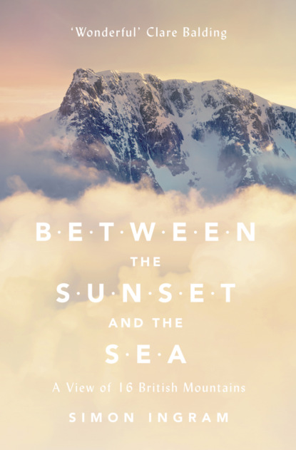
Between the Sunset and the Sea: A View of 16 British Mountains
Настройки чтения
Размер шрифта
Высота строк
Поля
It was now almost totally dark, the descent seemingly destined to be desperate. While my eyes had become accustomed to the gloom, night was biting, and soon I’d barely be able to see where I was placing my feet. I had a head torch somewhere in my bag but I didn’t want to use it unless I had to. Any bright light would destroy my night vision in a flash, and besides, I didn’t want to stop – not even to rummage in my rucksack.
It turned out that walking back towards Bwlch Giedd was a hell of a lot harder than walking from it. The wind was now punching me directly in the face, chilling my skin and making the simple matter of looking up almost impossible. I could barely see where I was going and the wind was doing its best to exploit this. Every time I took an uncertain step I felt the gusts attempting to pick me up, or snare my backpack sideways and try to pull me from my feet. I focused on my pacing and tried not to panic. All I had to do was get down before I became too cold to walk. That was all.
My instinct had been to get as far from the cliff edge as possible, but walking on the grass wasn’t so good; the grip between my boots and the ground wasn’t as positive as on the stone of the path. Trying not to lose balance or composure, I pushed on along the stones, distracting myself by trying to figure out how strong the wind was. A steady 50 mph was my guess, possibly gusting to 70 mph. This might not sound much when you’re sitting at home listening to it rattle the windows, but on a mountain trying to walk, anything over 40 mph and you’re struggling.
I reached Bwlch Giedd with considerable relief, and stepped into the shelter of the path that descended the escarpment down towards the lake. The sudden silence caused by the drop in the wind made me realise my ears were ringing. The path was rocky and trip-prone, but I managed to stay upright all the way down to the shore. Pulling out my compass and wrestling with the flapping, shiny cased map, I struck a straight bearing from the edge of the lake to the point where I’d parked the car. It would be a cold, damp walk out – but at least I was down. Now I had to get back across the rolling grass and several streams, and I’d be out of this wind, and out of this rain.
It took a while, but I managed it. Along the way I discovered the batteries in my head torch were almost flat, so the stream crossings were done in a darkness that was rather too profound for comfort. My compass bearing had been spot on, though, despite it being the headlight streak of a distant car that finally guided me back to my remote parking space. My final steps were beckoned by the little red blinking LED of my car alarm indicator. Even in mountain places – and dark-sky reserves, at that – it seemed electric light had its minor uses. I was intensely glad to be back at the car and, however foolish the decision had been, equally glad I’d pressed on, albeit at the cost of comfort. My trousers were so sodden I drove the 200 miles back home in my boxer shorts. Things had to get easier.
* (#ulink_4cdae149-ea37-5847-91f8-9e8213a5ec1d) If you’re interested (and who wouldn’t be!), the lowest quality for what is considered a dark sky – according to the International Dark Sky Association – is that ‘at a minimum the Milky Way should be visible and sky conditions should approximately correspond to limiting magnitude 5.0 (or Bortle Class 6).’ The Bortle Scale was created by John Bortle to aid astronomers, and runs from 1 (where shadows are cast on the ground from the sheer brilliance of the stars overhead) to inner-city skies of 8 and 9 (the sickly glow by which Bortle helpfully notes one can ‘easily read’).
* (#ulink_0bffe3f2-3376-5379-8abf-5df1c83c46ec) This is Exmoor, granted International Dark Sky Reserve Status in 2011. As of 2014, the other six reserves are in Namibia, New Zealand, Canada, France, Germany and Ireland. Honourable mention must go here to Galloway in southern Scotland, which in 2009 became a Dark Sky Park and has been decreed as naturally possessing the highest quality of dark sky. The difference between a park and a reserve is that the latter requires the cooperation of neighbouring communities to restore and maintain the quality of the night sky.
* (#ulink_27946c64-0a52-5362-9da6-db9bc5b240b2) It was reported with some degree of disgust that one of the songs the trespassers sang was the left-wing protest song ‘The Red Flag’, although several renditions of ‘(It’s a long way to) Tipperary’ were also given, as well as a modified version of Harry Lauder’s ‘The Road to the Isles’, with key locations in the song replaced with local landmarks for the occasion.
3 LEGEND (#udee40a0e-8cb7-58c9-997d-92b4924499db)
Somewhere between the Brecon Beacons and the country’s north coast, the mountains of Wales sharpen and slough off their grassy skins. Southern Snowdonia marks the changing point, and here there’s a belt of mountains evidently conflicted about which camp they belong in. The shapes of these ranges waver between the cutting ruggedness of the peaks in the northern part of Snowdonia and the queer emerald forms of their counterparts in South Wales. The names of the big groups of hills here tickle recognition for some, but only just: the Arans, the Tarrens, the Dovey Forest, the Rhinogs. Journey from the south into this region and steep diagonals, or the jag of a peak on the skyline ahead might symbolise your steady transition to the wild, hard north. But conversely, enter from the north and you might describe the landscape around you as softening, easing towards the sprawling south. It’s a fascinating, disjointed menagerie. Then you see Cadair Idris, and suddenly you’re not looking at anything else.
A month after being nearly drowned on the Black Mountain, I found myself in southern Snowdonia during a spring that had finally sprung. Colour had returned to the landscape. New life was exploding. Bluebells bobbed on embankments beside roads sweeping through richly-carpeted passes and tired-looking villages. Sunlight diffused through new leaves, lighting the world through miniature shades of green and giving the afternoon a feeling of intense optimism.
I’d spent an uncertain twenty minutes dividing my attention between the road and the skyline – punctuated occasionally with visits to the rumble strip – trying to establish whether my objective was sliding into view ahead in some distance-skewed fashion. When it finally did appear, it seemed preposterous to think I could miss it.
There’s evidence that the Elizabethans considered Cadair Idris to be the highest peak in the British Isles, and it’s an easy mistake to forgive. Approach it from the north and it smacks you in the face from a distance of ten miles. It’s massive: a wide, wrinkled battlement of brown, crag-hung rock sprawled across the southern horizon with intimidating abruptness. Showell Styles – author of The Mountains of North Wales, of which more later – described the vision of Cadair from the north as a ‘hunched eagle with a tremendous wingspan’, and it’s wonderfully apt. Cadair isn’t the highest peak in this part of Snowdonia – not quite – but its visual presence is enough to make it seem as if it is. Perhaps this apparent brawniness is because the mountain’s base is at sea level, thereby earning every millimetre of its 893-metre height over a relatively short distance. The town of Dolgellau, just to the north, sits on the zero contour and so completes the contrast on a human scale. But the reflex assessment upon sighting Dolgellau isn’t that it nestles up against Cadair Idris; it’s more like the town cowers beneath it.
I chose the climb from Talyllyn, a way known as the Minffordd Path. Some say the path from the north – the Fox’s Path, which climbs the cliffier aspect of the mountain directly – is the best. From the north Cadair appears as a massif of three summits, split into upturned prows in several places by aggressive staircases of ridge. It appears impossibly impregnable, and impressively immense. The Fox’s Path offers superb views of the Irish Sea, Dolgellau below, and the bristly Cyfrwy Arête, probably the most blisteringly dramatic ridge climb south of Scotland. But this route doesn’t take you into the mountain’s inner keep; it climbs this northern wall and, once atop, walks the ramparts to the highest point, missing one of the main arenas of the mountain. Plus, instead of one hard ascent, the climb from Minffordd is a languid, gentle rise, followed by one mercifully swift but screeching pull. To me, it seemed to be the best choice to appreciate the many levels on which Cadair engages the senses. Plus, with memories still raw from the Black Mountain, it clearly seemed the preferable option – especially since, having not learned my lesson in the Brecon Beacons, I had a summit sleepover planned.
Rounding the corner at the Gwesty Minffordd Hotel, I swung immediately right into the smooth, wooded car park. I was late. Dinner in the seductive surroundings of a fast-food restaurant – and many stops along the road to admire the views amidst the day’s deepening shadows – meant that my plan for getting to the summit by sunset was now on a perilously tight schedule. In my pocket was a mobile phone newly loaded with GPS mapping software, which I’d decided to bring as a backup to my map following the collapse of my planning on the Black Mountain. It was not only prudent, but genuinely useful; although keen to find my way by my nose as much as possible, with traditional navigation as a failsafe, I had no qualms about using reliable gadgetry to ease my way. If anything, it would help me keep my eyes on the landscape rather than buried in a map. Pulling my overnight rucksack from the boot, I hastily chucked in a few provisions already bagged up in waterproof bags – some of which I’d labelled with helpful words like ‘food’, some of which I hadn’t – doubled-back to check the car was locked and set off into the mild evening air in something of a fluster, giving a quick look around the car park as I went. It was deserted but for one other car. With a plunging feeling I realised its owner might have similar designs on inhabiting the summit for a night, but just as I approached the gate onto the path I saw two walkers emerging into the car park, looking pink and happy. One, a greying man with a map case around his neck, smiled as he held the gate for me. ‘All yours,’ he said. And with that, I had one of Britain’s most atmospheric and intricately legendary mountains all to myself.
The mythology associated with mountains is prolific, and pervades cultures regardless of time or place. The reason for this isn’t really a mystery: they are the land’s most obvious, most dramatic physical feature. But those early peoples who settled beside mountains didn’t see them as objectives, or assets; they feared them.
Since the earliest ages of civilisation the mountains have been the homes of gods and demons. Like the sea – that other great unconquerable – the mountains’ physical size and fickle moods meant that they were seen as both forbidding and forbidden. Although many people saw them as dark places of evil and the meddling of spirits, some optimistic cultures viewed them as protectors, even mothers. But neither saw them as places for people to tread.
Understandably, it’s the most striking, massive or isolated peaks that demand the most attention and stir the most potent awe, and it’s hardly surprising that such mountains across the world have become sacred.
Kailash, an enormous, free-standing peak in Tibet, is perhaps the most famous of these, amongst both mountaineers and students of religious philosophy alike. Unfeasibly dramatic, 6,638-metre Kailash rises sheer, a topographical exclamation mark ascending so drastically from the mud-brown of the Tibetan plateau the vision of it is surreal from all sides. Located near the source of several rivers, including the Indus and Brahmaputra – which collectively irrigate land supporting over a billion people – the mountain is sacrosanct to several religions. In Hinduism, Kailash is said to be the home of Shiva, destroyer of ignorance and illusion. Buddhists believe the mountain is the place where the Buddha Demchok sits on the summit in eternal meditation. Many believe the summit is the final step to heaven; yet all consider that stepping onto its slopes leads to death, damnation or the opening of Shiva’s third eye – a highly undesirable event said to trigger the end of the universe.
Pilgrims to Kailash brave altitude and often brutal sun to be in the mountain’s presence. A common form of worship is to circumnavigate it, some 33 miles of rough path and sharp rock. Many feel suitably moved to make this journey in penance, prostrating themselves at full length on the ground, indenting the dust with their fingers, resting their heads on the rock and saying a prayer, repeating this for the entire length of the walk. This can take several weeks, after which the successful pilgrims return home, often with enormous welts on their fingers, feet and foreheads, and one hopes enlightenment in their souls.
No mortal has climbed Kailash; to do so would insult those to whom the mountain is sacred. As for immortals, it’s written in legend that 1,000 years ago, the Tantric Buddhist Milarepa challenged Naro Bön-Chung of the Tibetan Bön religion to a contest decided by a race to the mountain’s summit, although their method of ascent cannot be strictly considered ‘mountaineering’ by today’s standards.* (#ulink_768521d8-4a20-5610-8bd4-fa3e5d073231) Several Western mountaineers have come close, but either declined their permits or found themselves pressured into doing so by others in the mountaineering community. One of these – the Italian mountaineer Reinhold Messner – stated of Kailash: ‘If we conquer this mountain, then we conquer something in people’s souls.’
In the Indian Himalaya above Sikkim, Kangchenjunga – the third-highest mountain in the world – is another such sacred summit. Again, the mountain’s physical presence is striking, and directly linked to the reverence it’s accorded by those of the Kirant faith. Its name means ‘Five Treasures of the Sacred Snows’, referring to the mountain’s five summits and the holy repositories they are said to harbour: gold, silver, gems, grain and holy books. As with Kailash, to step on its very summit is considered a desecration, and in 1955 – in a most admirable demonstration of self-restraint – the British climbers Joe Brown and George Band, having just made the first ascent of the mountain, stopped several feet short of the pristine snow cone on the very top in deference to this belief. This tradition continued on every ascent until 1980, when members of a large Japanese expedition reputedly trampled all over it.
Closer to home, mountains have been accorded similar – if somewhat more niche – respect. Above the southern Lake District, the Old Man of Coniston is a stately 803-metre mountain that draws many walkers to it for pleasurable day walks. Most don’t know it’s also considered the fifth most sacred mountain in the world by a religious sect called the Aetherius Society. To them, the mountain is a store of spiritual energy that, when unlocked by prayer vigils, is said to radiate out to those in need across the globe. The focus of this is said to be a table-shaped rock located just north of the summit, near which the group often congregates to pray. Basing their beliefs on the existence of extra-terrestrial intelligence – or ‘gods from space’ – Aetherians see mother earth as a deity who sacrificed herself to provide a home for a flawed, brutal humankind. The religion was founded by Dr George King, who in 1958 was visited whilst climbing Holdstone Down in North Devon by a ‘great being of love’, who sent streams of energy through him deep into the mountain, making it forever a holy repository. King was then instructed to travel to eighteen other mountains and ‘charge’ them with spiritual potency. Nine of these lie in the British Isles, the others being iconic (or obscure) peaks abroad.* (#ulink_084c2659-c922-5b3d-ac20-f46d27e4b8ab) Aetherius pilgrimages are organised to these mountains to this day.
And so to Cadair Idris, which is perhaps the most concentrated meeting of myth and mountain, certainly in Britain. For that, we can thank the rich seam of Welsh legend that perfectly complements the mood of the landscape and its reflective, storytelling people. This is the land of the Mabinogion, the collection of eleven medieval folk tales that coalesces thousands of years of fable into one delicious mix. The Mabinogion takes the form of a book; if it took the form of a mountain, it would be this mountain.
The legends that haunt this place are strange and old. Many have become exaggerated over time; most were fantastic to begin with, although some have their roots in history and in truth. The name Cadair is the mountain’s correct spelling, despite frequently being given as Cader. There’s no deeper reason for this than the pronunciation of the longer word in the local dialect. The translation of this prefix is both ‘hill-fort’ and ‘chair’. The suffix, however, is a name.
Your first steps onto Cadair on the Minffordd Path take you through a forest of sessile oak, where the path ascends slopes veined with stepped waterfalls. It was mild enough to set off wearing a T-shirt, and soon I was beginning to sweat. The sun had long dropped below the point where it could pierce the canopy and light the ground, and the forest was darkening and thickening with clouds of biting midges, which made stopping unwise. My pack felt heavy – heavier than it should, somehow – and my breathing soon became laboured, and progress unsteadily erratic.
Climbing alone didn’t seem to be something I was yet particularly good at. Of all the mountains I’d walked up over the previous years, I pretty much always had someone with me – and that someone was usually in front, setting the pace, taking the worry out of route-finding and being, physically and psychologically, something to follow. Climbing a mountain is a very measurable commitment. You either get to the top, or you don’t. And like every commitment, whilst sharing it gives it much more retrospective cachet, on the hill the act often turns into a who-blinks-first matter of pride.
This gentle competitiveness helps you get through the physically hard moments. It pushes you on for just a few more metres of ascent when you feel like all you want to do is curl up, leak sweat and carbon dioxide for a few minutes, and then maybe die. Looking at a mountain on a map at home is easy. It’s just a squiggle, rarely bigger than the base of a wine glass and usually small enough to eclipse with your thumb. This – more so if the wine glass happens to have had something in it – has the effect of inflating your ambitions. But out in the real world the second you hit a steeply raked slope with a rucksack on your back, your pace slows, your breathing gets stiff and you’re staring up at something impossibly high above you. It’s at this point that those ambitions have the habit of playing dumb and mutinously slinking away – and you remember just how much harder climbing a gradient is to walking on level ground.
If you’re alone nobody will judge you for it. You can go as slowly as you like, and no one will see. I could babble to myself, have a wee without saying ‘I’m just having a wee’ to anyone, or sit down for ten minutes every five metres. On the occasions you pass another walker, of course, you puff your chest out, close your mouth so as not to appear out of breath, quicken your pace and do your best to look like a strident mountain person before deflating and re-reddening as soon as they’re out of sight. But by and large, when alone you’re your own motivation – and there’s nobody to silently scold you for being slow or unfit but yourself. You can turn round if you want. Go home. Nobody’s stopping you. And that takes some getting used to.
Tonight, at least, I had the sunset to race – though after twenty minutes this wasn’t going so well. It was approaching 9 p.m. when I entered Cwm Cau to see the last blush of sunlight colouring the very tops of its crags. Half an hour later, and it would be sinking into the Irish Sea. If I wanted to get to the top to see it do so, I didn’t have long.
A cwm is the Welsh word for a valley, usually a glacial cirque, and Cwm Cau is perhaps the most perfect glacial cirque in Snowdonia. A sculpture fashioned by massive glacial forces, the beautiful black-blue lake at its centre has inspired much of the mountain’s legend, and some of the more questionable deductions of scientists who have studied it. The lake is almost fifty metres deep in places. Resembling the broken neck of a glass bottle, the dramatic ring of peaks surrounding it once led many to think Cadair Idris a long-dead volcano – and the image still appeals. But it’s wrong. The rock is volcanic, like that of much of Snowdonia. But this rock erupted onto the floor of a great sea, was thrust upwards in a period of mountain building, then worn down and defined in form by aggressive glaciers over hundreds of millions – possibly billions – of years. Smothered by the Pleistocene glaciation, the ice lay so steeply against the mountainside that it slid in hard rotation, grinding against the dolerite rock and slowly scooping out the basin we see today. The headwall against which the glacier terminated – the pyramid of Craig Cau – was frost-split, clawed at and dragged against by the glacier, leaving the mountain’s impressively scored appearance as a legacy and adding to the raw allure of the cwm. Why anyone would want to miss this part of the mountain is a mystery all of its own.
The crags rise vertically several hundred metres from the lake to a big-dipper skyline, which, seen from the entrance to the cwm, climbs from the left to the dominating peak of Craig Cau – often, due to its pyramidal shape, mistaken for the massif’s topmost summit – before dropping to a nick in the ridge then climbing again to the right, up to the highest point of the mountain itself, known as Penygadair.
Away from the shifting of the leaves of the lower path, the cwm was noiseless. In the same way your eyes become tuned to the dark, so your ears respond to silence. As I entered the huge basin and began to edge around the lake, my senses were numbed. I stopped to take a breather, and slowly sonic details began to peep through. The delicate sound of water tickling the shore, the hard ‘chack’ of a wheatear ground-nesting nearby somewhere; faint, audible traces of nature emerging from a landscape so quiet you had to listen hard to hear it. As I moved I noticed white crampon scratches like tapeworms doodled up the rocks at the water’s edge. Walkers had been here when all of this was white. In winter the lake would be frozen, perhaps snow-covered. You wouldn’t know where the edge was.
My route lay in the north-west crook of the basin, and looked steep. It climbed the slope via a shallow, rocky groove to the ‘v’ in the ridgeline between the pyramid of Craig Cau and the summit, still invisible above and to the right. In the gloom I could see a patch of white that looked about mid-way up – probably a quartz vein – which I made a mental note to look out for. Gauging the progress of your ascent from a slope can be tricky; everything above you looks closer than it is, and everything below further away.
I looked up, and then down at my watch. Darkness was chasing the light east to west across the sky. Invisible, beyond the bulk of the mountain over the sea, the sun would be setting. Night was coming.
Cadair’s ‘Idris’ was most probably Idris Gawr, a king of Meirionnydd – a region of medieval Wales. Today most of Meirionnydd is part of the county of Gwynedd. But at the time of Idris, around AD 600, it was a kingdom of mountains and coast occupying the area of southern Snowdonia in which Cadair Idris sits.
It’s at this early juncture that things get a little muddled. The direct translation of Cadair Idris is literally ‘chair’ or ‘stronghold of Idris’. Some versions of the legend state that Idris was a giant so large he could sit using the entire mountain as a throne from which to survey his kingdom. Other versions state that the mountain received its association because Idris the king would climb to the summit and stargaze. Yet more state that the king retired to a hermitage – or fort – on the mountain in his later years. Further ambiguous threads of the tale indicate that the ‘chair’ referred to was an actual rock-hewn object on the summit, natural or otherwise, upon which Idris would sit and do whatever it was that he did.
However delicious all of this is, whoever Idris was, it would seem that in this region, at some point he did exist – and for whatever reason he became inexorably associated with the mountain.
It was written as far back as around 1600 by Siôn Dafydd Rhys in The Giants of Wales and Their Dwellings that ‘in this high mountain formerly lived a big giant, and he was called Idris Gawr.’ He goes on to describe some other myths about the mountain, including one that seems to suggest an early version of subterranean Poohsticks: ‘If a stick or other piece of wood be thrown into any you may choose of those waters, you will get that wood in the other lake on the opposite side of this mountain.’ There are many references to Cadair’s numerous lakes being bottomless, or home to the afanc – a kind of water serpent that had been cast into Llyn Cau by King Arthur, no less.* (#ulink_155c6e83-ad8b-55e0-bf17-b01acf3d737e) Gwyn ap Nudd, the Celtic Lord of the Underworld, was also said to dwell here, and his scarlet-eared cwn annwn – loosely, hounds of hell – are said to glide across the summit, seeking souls to steal and no doubt ghostly walls to pee against. It’s said in mythology that the howling of these dogs (loudest further away, and quietest close to you) was a premonition of death to anyone who heard them. Many associated the bark-like honking of migrating geese by night with the legend. But the story that really stuck – the one most enigmatically associated with the mountain – is also contained within The Giants of Wales and Their Dwellings. ‘On the highest crown of this mountain is a bed-shaped form, great in length and width, built of slabs or stones fixed around it,’ it states. ‘And it is said that whoever lies and sleeps on that bed, one of two things will happen to him: either he will be a poet of the best kind, or go entirely demented.’
Long before the 17th century, Celtic lore speaks of pilgrims who journeyed to Cadair Idris with the express intention of climbing to the top at sunset and spending the night there. The experience, if successful, was said to lift the traveller to a higher spiritual plane, becoming a filidh – which means both ‘seer’ and ‘poet’. The filidhean filled a void that druidism was rapidly vacating, and were seen as conduits between the spirit world and humankind who could see beyond the world of convention and impart imbas – the knowledge of enlightenment – to the people. It was said the process of becoming a filidh required the traveller to shed all identity and return to the world with a new narrative – hence ‘poetry’ – for life. This process could, of course, go wrong. If unsuccessful, the result would be too much for the pilgrim to bear, and he would descend into madness or die on the spot.
It’s a common motif. Mount Zion, Mount Horeb and Mount Sinai in the Old Testament, and Mount Olympus in Greek mythology, are summits dense with religious symbolism or host places where dramatic enlightenment has taken place. But it’s striking that this comparatively modest mountain in North Wales appears with such potency in so many legends. And, because spending the night on the mountain seemed such a recurring feature of these legends – whether to gaze at the stars from a giant chair, look over an ancient kingdom, be eaten by a ghost dog, dragged to hell by the god of the underworld, ascend to a higher plane of wisdom, become a poet, go insane or simply die – well, it seemed like the thing to do.
Cwm Cau was deep in shadow, and chilling quickly. Finding the outlet to the stream that fell from somewhere near the top of the mountain, I filled my water bottle from the place where it flowed the fastest. This would be the last of the water I’d find now, and the safest to drink, relatively speaking. I unclipped my bag and filled the clear bottle I carried. Normally I’d hold it up to the light to see if I’d caught anything interesting in there, but there was no light. Of course, if there was anything really sinister in there I wouldn’t see it; viruses, protozoa, the gunge from the mulching body of a dead sheep unseen upslope. High, mossy streams like this are pretty good at breaking down contaminants, given a clear run of flow, but wild water is always a gamble. A measured gamble, but a gamble all the same.
Nearby, a rough footway began to ascend. I took it, feeling the cold of the rock bristling against my bare arms as it steepened, closer to my body than before. Next to me, the crags of Craig Cau ceased to be a wall of cracked rock, more a side of broken ribs descending from above, separated by gullies scraped into the mountain.
It was hard going. Breathless, I began to set targets. A stop at the sheep. A drink of water at the white rock, whenever it appeared. To get me there, a few sweets. Finally, I reached the white rock I’d spotted from the Cwm. It was quartz – a massive cataract of it, bent and fractured where it broke the surface. I stopped, looking down at the darkening water below, and back up at the slope stretching above me. Maybe a hundred metres left.
The next section was tougher, both in terms of the terrain and my dimming evening energy to tackle it. The path was starting to lose its mud-and-stones constitution, and more and more stretches of bare rock had to be crossed and climbed. Soon I was amongst sharply raked cracks of stone that required both hands; several times as I hoisted myself into these I caught sight of the increasing drop through my legs below. As I began to draw level with the skyline, a sniff of breeze began to drift downwards from above, suddenly becoming a gust as the sky grew wider. There was the white nape of the coast and its necklace of amber lights. The horizon was gone, smudged by gloomy mist. And to my right, a mercifully gentle-angled path began to lead upwards through jumbled boulders to the summit of Penygadair – the top of Cadair Idris.
After a few moments’ rest I slowly but robustly began a slumping gait upwards along the path. It was getting cold, but I’d soon be on the top, and soon able to layer up and get warm. The world was now deepening blue tones, with no trace of the colour of sunset left except for a messy smear of orange across the western sky.
My ears were becoming nervy. A sheep’s cough sounds disturbingly like a human choke – at least it does when you’re high and alone on a mountain in increasing darkness, and the silence seemed to have bulk, a kind of sonic hiss like distant traffic, as I continued along the ridge. The views on each side began to widen and I started to feel like I was reaching the top of something. At last, barely perceptible, the white Ordnance Survey trig pillar – perched atop a tall pile of rocks evidently comprising the summit – appeared ahead. I clambered up, pausing for the briefest moment to enjoy being at the apex of that massive ridge I’d seen earlier from the road, then quickly began a visual search for Cadair’s second most distinctive summit feature. Glancing around from the trig point, beneath me to the right I spotted a uniform row of stones, and then a patch of corrugated tin they edged. In the blurred contrast of the gloaming, so well does it mimic the native stone of the summit you could easily mistake it for a weathered sheet of metal lying on the ground, perhaps covering some sort of hazard. But it isn’t. It’s a roof.
The hut was built in the 1830s by a guide named Robert Pugh. He had a vested interest in constructing a building in this rather auspicious place – if not for a financial gain then certainly a practical one, as Cadair Idris was big business for local guides in the late 18th and 19th centuries. Its status as one of the most southerly big chunks of proper mountain in Britain, and its dramatic qualities – which mirrored many of those of Snowdon, twenty miles to the north – drew visitors from afar. The guides they hired were often colourful local characters typically acquired at inns in Talyllyn and Dolgellau who could make their sole living escorting artistic travellers and science buffs – to whom Pugh applied the neat collective ‘curiosity men’ – to the summit of the mountain.
Geology was a major preoccupation for these early travellers. Before glaciation and erosion reduced its height by thousands of feet and carved it into its present form, the Ordovician volcanic rocks and Precambrian sedimentaries that form the bedrock of the mountain once extended northwards in a huge arch of layered rock beds. This arch reached its apex high above the central region between Cadair Idris and Snowdon, and is known as the Harlech Dome. This is an ancient sea floor, folded like a rucked carpet and considered one of the oldest geological formations in Britain. It’s also the reason fossilised seashells have been found on Snowdon’s summit. The rocks in the face of Craig Cau can be seen to tilt southwards, showing the slope of this arch, like the abutments of some collapsed Roman fortification. We know all of this now, but in the 19th century it was all still a fascinating puzzle waiting to be solved. Cadair’s botany, too, was and is of particular interest; today the mountain’s status as a nature reserve comes from the delicate and unusual alpine plants that can be found at their most southern extent on its slopes, including purple saxifrage, the prehistoric-looking green spleenwort and pretty little white-flowered spignel.* (#ulink_e5ee845d-c541-5b31-9f88-d704a27cfbd5) The summit ridge is a bouldery grassland, where can be found the evocatively named hare’s tail cotton, and wavy hair grass.
A telling early description in literature of Cadair comes from Daniel Defoe, who visited the area in the 1720s. He was not a man to delight in wilderness; he describes the area as being home to mountains ‘impassable … which even the people themselves call them so; we looked at them with astonishment, for their rugged tops and the immense heights of them.’ He goes on to mention the ‘famous Cader-Idricks, which some are of the opinion is the highest mountain in Britain’. Alfred Lord Tennyson was another visitor to the mountain – in a storm in 1856 – and was sufficiently moved by it to say he had ‘never seen anything more awful than the great veil of rain drawn straight over Cader Idris’. The diarist Francis Kilvert was escorted to the summit by Pugh’s son in 1871, and his account was similarly bleak: ‘This is the dreariest, stoniest, most desolate mountain I have ever been on.’
Последний отзыв
Книга довольно хорошо написана в виде рассказов старого человека молодому парню, основанных на событиях его реальной жизни, охватывающей период с нача...
Далее